


How Drones Are Revolutionizing Traffic Incident Management (TIM)?
Traffic incidents can disrupt road networks within seconds, and if left unresolved for just ten minutes, can trigger secondary accidents, negatively impacting lives, time, and finances, and leading to prolonged road closures.
How to accelerate traffic incident response and management? Aerial drone technology has shown immense potential in traffic accident investigations, enabling rapid response, post-incident recording, and aiding in on-site reconstruction.
Let's explore how drones are revolutionizing Traffic Incident Management (TIM)!
What is Traffic Incident Management (TIM)?
Traffic incident management refers to the management of incidents that affect road safety and traffic flow. The purpose of Traffic Incident Management (TIM) is to mitigate the impact of road incidents by enhancing the accountability of incident responders, standardizing on-site operations, and accelerating lane clearing urgency.
The Traffic Incident Management (TIM) process includes incident detection, incident verification, on-site assessment, responder coordination, traffic control, incident investigation, on-site cleanup, traffic restoration and monitoring, and post-incident reconstruction.
The first step in restoring traffic flow is timely response and faster, more accurate accident investigation.

Why Does Traffic Incident Management Require More Advanced Technology?
Traditional traffic incident responses typically rely on emergency calls, roadside cameras, patrol vehicles, traffic sensors, and information provided by people near the accident scene.
However, traffic accident situations can change rapidly, and secondary collisions can occur while vehicles are queuing and alternating. Therefore, modern Traffic Incident Management (TIM) projects increasingly emphasize situational awareness and rapid information sharing.
The Federal Highway Administration (FHWA)'s Next Generation Traffic Incident Information Management (TIM) project explicitly states that Unmanned Aerial Vehicle (UAS) systems can enhance situational awareness, reduce accident scene mapping time, and help emergency responders handle incidents more efficiently.
In accident investigations, UAS systems perform on-site mapping, saving more than 300% of the time compared to 3D laser mapping. —NCDOT. "Collisions Scene Reconstruction & Investigation Using Unmanned Aircraft Systems," August 2017. Small drones use high-definition digital cameras to capture images, and their operating costs are only a fraction of those of manned flight operations.

How Can Drones Assist Traffic Incident Management?
Drones can serve as an aerial information layer between roads and traffic management centers. Agencies can deploy drones to provide aerial views of accident scenes instead of relying entirely on information from ground-based emergency personnel.
The Federal Highway Administration (FHWA) explicitly states that the application of Unmanned Aerial Vehicle Systems (UAS) in Traffic Incident Management (TIM) includes accident verification, situational awareness, detour monitoring, and congestion detection and monitoring.
Introducing drone systems into traffic management can provide information that helps emergency responders make decisions faster and better.

1. Faster Accident Detection and Verification
One of the primary challenges in Traffic Incident Management (TIM) is determining the actual situation of an accident. Drones can provide an aerial perspective to help operators verify the situation.
Drone on-site investigations can not only focus on collision details, vehicle malfunctions, and road debris, but also plan lanes and identify alternative routes with a broader field of view, alleviating traffic congestion and restoring traffic flow.
2. Improved Situational Awareness for Emergency Response Personnel
Traffic accidents are dynamic. Vehicle positions, traffic congestion, emergency vehicles, and road hazards can all change continuously. Drones can provide emergency responders with an aerial view to assess the surrounding environment, supplementing information from patrol vehicles, traffic cameras, and on-site personnel, and helping agencies coordinate responses more effectively.
3. Reducing the Risk of Secondary Accidents
Secondary accidents are one of the most concerning safety issues in traffic incident management.
When an accident blocks a lane, approaching drivers may encounter sudden congestion or vehicles coming to a stop.
If drivers do not receive sufficient warning, the initial accident may trigger another collision further upstream.
Drones can help monitor traffic congestion from the air, monitor roads behind the accident site, and determine the extent of congestion, assisting traffic authorities in lane management.

4. Faster Accident Scene Recording
Traditional accident scene recording may require emergency responders or investigators to spend considerable time measuring distances, photographing vehicles, recording road conditions, and collecting evidence.
Drones can capture aerial datasets of the scene (vehicle locations, road markings, skid marks, road geometry, and debris spill areas) and provide investigators with detailed visual information.
Mapping drone aerial images can also support 2D mapping and 3D reconstruction. This is crucial for accurately recording the causes of accident-prone road sections.
It is especially important for serious or complex traffic accidents in road environments.
5. Monitoring Traffic Queues and Congestion
Traffic accidents commonly occur in high-traffic, narrow, and merging sections. A blocked lane can lead to an ever-increasing queue, impacting upstream intersections, highway ramps, and alternative routes.
Queue monitoring is a vital component of Traffic Information Management (TIM). Drones can provide a wide-area view of traffic conditions, helping operators understand queue lengths, traffic density, and detours.
In cases of slow-moving traffic, drones can also help determine whether traffic is recovering or whether congestion still requires intervention.
6. Thermal Imaging Assists Nighttime Traffic
Many people choose to travel at night during holidays to avoid peak traffic hours. However, traffic accidents don't only occur during the day. Furthermore, accidents are more likely to occur at night due to fog, storms, or other low-visibility conditions, resulting in slower response times and greater difficulty in on-site investigation.
In traffic incident management, drone thermal imaging can help operators identify people near the accident scene, vehicles in low-light conditions, hot-spotted components of vehicles, and areas requiring further inspection. Starlight cameras can even see through vehicle windows.
For example, the Autel EVO II Dual 640T Enterprise V3 combines a visible light camera with a 640 × 512 thermal imaging camera. This thermal imaging system supports radiation temperature measurement and night vision applications.

7. Supporting Highway Patrol and Emergency Response
Drones can support highway patrol and emergency response teams at accident scenes, providing aerial views for police officers, firefighters, emergency responders, transport personnel, or tow trucks on the ground.
FHWA's TIM framework covers law enforcement, fire and rescue, emergency medical services (EMS), transportation/public works, towing, and other response agencies. Drones can serve as a source of shared information among these teams.

8. Integrating Drones with Traffic Management Centers
High-performance enterprise drones offer open third-party SDK entry points, allowing integration between drones and a wider range of traffic management systems.
Organizations don't need to wait until an incident occurs to use drones; instead, they can integrate drone operations into a broader Traffic Information Management (TIM) workflow.
Traffic management centers can receive information from multiple sources, and drones can provide additional aerial perspectives when needed.
9. Combining Drones with Artificial Intelligence and Digital Mapping
A single drone flight can generate a wealth of visual data. This information can quickly reflect on-site conditions such as traffic flow, vehicle queues, road congestion, and real-time road condition monitoring. Mapping techniques can also convert drone images into 2D orthophotos or 3D models.
RTK-enabled drones can provide high-precision positioning information for mapping workflows, aiding in incident reconstruction. For example, Autel's EVO II RTK series drones can record camera center positioning information with centimeter-level accuracy and absolute coordinates.

10. Choosing the Right Drone for Traffic Incident Management
When selecting the right drone for traffic incident management, camera specifications are no longer the sole consideration. From emergency response and incident investigation to incident reconstruction, the best drones must be fully integrated into the organization's complete Traffic Incident Management (TIM) workflow.
Drone Thermal Imaging
For nighttime, low-light, and emergency applications, thermal imaging cameras can provide additional information beyond visible light images.
High-Resolution RGB Cameras
High-resolution visible light cameras with optical zoom are crucial for accident recording, road inspection, and mapping.
RTK Positioning
RTK improves positioning accuracy in mapping and measurement workflows.
Flight Time
Longer flight times reduce the need for frequent battery changes during prolonged accidents.
Weather Resistance
Highway accidents can occur in adverse weather conditions. Appropriate enterprise-grade drones should be selected based on the organization's operating environment and manufacturer specifications.
Zoom Capability
Non-destructive optics or high-magnification digital zoom can help operators inspect targets from a safer distance.
Nighttime Operations
Low-light performance, thermal imaging, and appropriate lighting options are critical for nighttime accidents. Enterprise drones with searchlights are already a common tool in traffic management.
Data Management
Drones should integrate into the organization's existing workflows for storing, sharing, analyzing, and recording accident data.
Regulatory Compliance
Organizations must also operate their Unmanned Aerial Vehicle (UAS) systems in accordance with applicable aviation regulations, institutional policies, and local operational requirements.
Autel Enterprise-Grade Drones for Traffic Incident Management
For organizations exploring enterprise-grade drone solutions, Autel's enterprise platform supports multiple functions related to Traffic Incident Management (TIM) operations.
Autel EVO II Dual 640T Enterprise V3
The EVO II Dual 640T Enterprise V3 combines visible light imaging with a 640 × 512 thermal imaging camera, making it particularly suitable for emergency response and nighttime incident handling. Adding searchlight and loudspeaker payloads to the drone further enhances nighttime response and personnel rescue.
$1700 OFF 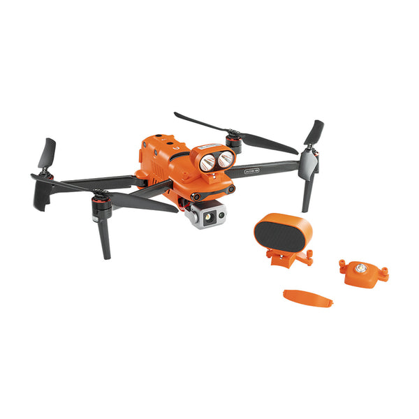
Autel Robotics EVO II Dual 640T V3 Thermal Drone Enterprise Bundle
$5299.00 USD
Autel EVO II RTK Series
For applications requiring precise aerial surveying, platforms equipped with RTK support accident scene recording and reconstruction workflows.
The EVO II RTK series supports absolute positioning and camera centering information, making it suitable for workflows requiring precise geospatial information. It plays a significant role in accident scene mapping, 2D orthophoto generation, and 3D reconstruction.
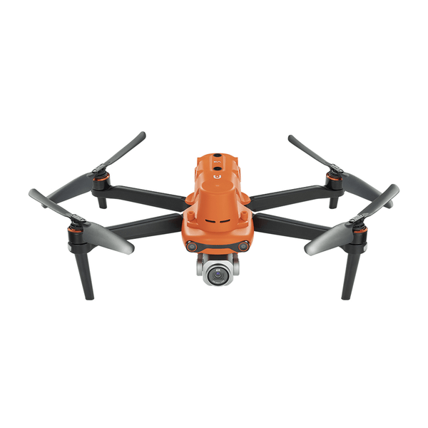
Autel Robotics EVO II Pro RTK V3
$2,999.00 USD
20MP 1-inch CMOS sensor | 1 cm + 1 ppm horizontally | 1.5 cm + 1 ppm vertically | RTK/PPK/A-RTK Buy Now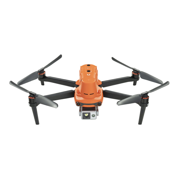
Autel Robotics EVO II 640T RTK V3
$5,799.00 USD
640*512 Thermal Camera | 1 cm + 1 ppm horizontally | 1.5 cm + 1 ppm vertically | RTK/PPK/A-RTK Buy NowAutel EVO Max Series
For more demanding public safety and transportation operations, the EVO Max mission-ready platform can be part of a broader enterprise drone strategy.
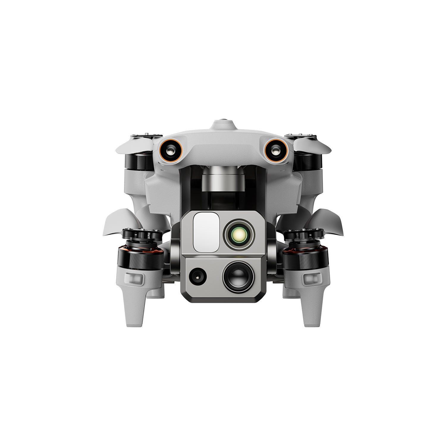
Autel Robotics EVO Max 4T
$8999.00 USD
640*512 Thermal Camera | 1.2km Laser Rangefinder | 50MP Wide Camera | 160x Zoom Camera Buy Now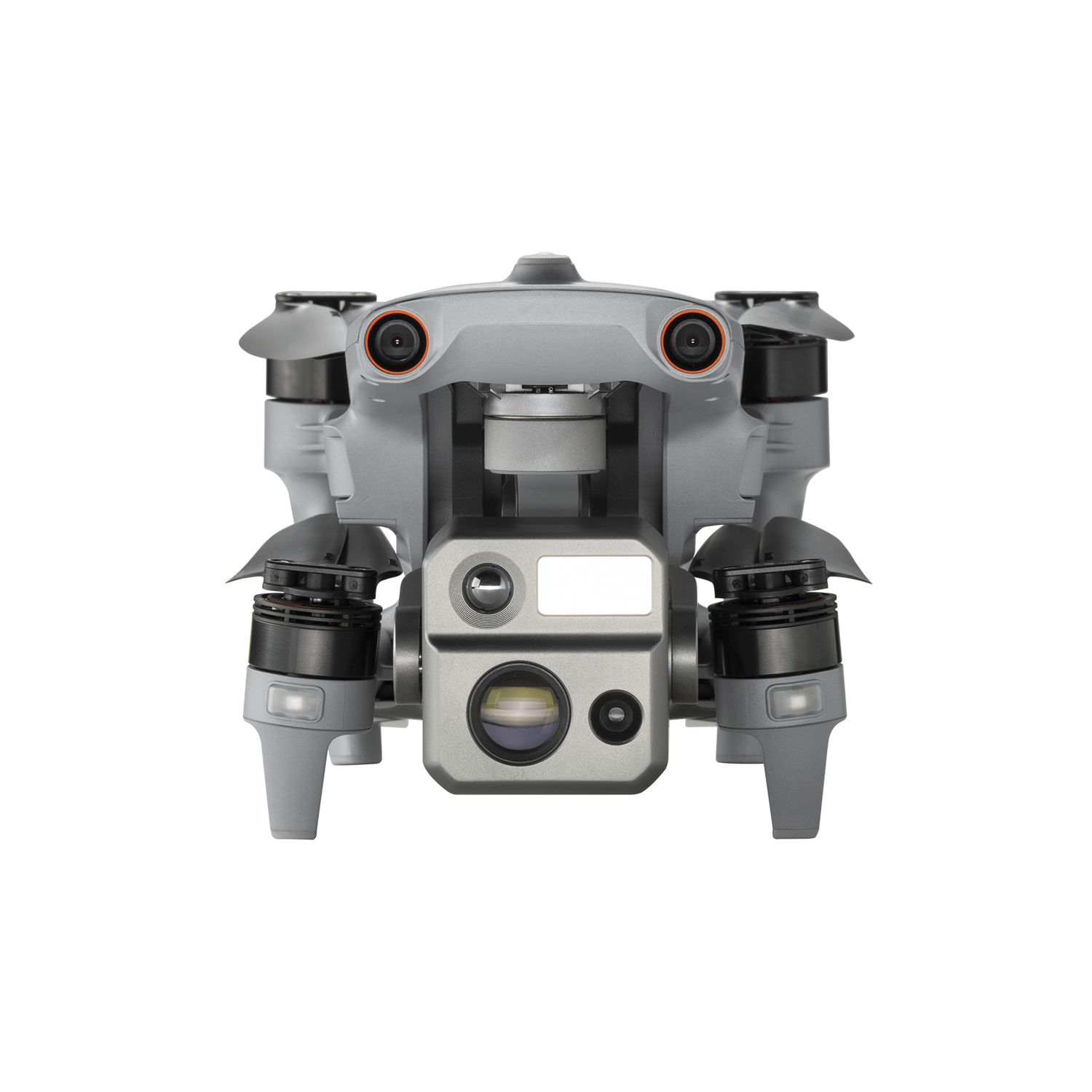
Autel Robotics EVO Max 4N
$1,2599.00 USD
640*512 Thermal Camera | 1.2km Laser Rangefinder | 50MP Wide Camera | 0.0001 LUX Starlight Night-Vision Camera Buy NowThe EVO Max drone boasts powerful performance, multi-sensor payloads for various scenarios, 8K 10X optical zoom, 0.01 lux night vision, strong anti-interference capabilities, autonomous obstacle avoidance, stable communication, and can be equipped with Max RTK modules, Payload Drop Systems, Max Loudspeaker And Spotlight Combo. A-Mesh networking technology provides a solid foundation for remote autonomous drone operation.
Conclusion
The core of traffic incident management lies in speed, safety, coordination, and information.
Traffic drone platforms provide an aerial perspective for accident verification, enhance situational awareness, monitor traffic congestion, support accident reconstruction, utilize thermal imaging technology to assist nighttime operations, and reduce the time personnel spend working directly on busy roads.
With the increasing integration of Unmanned Aerial Systems (UAS), Real-Time Kinematic (RTK) mapping, thermal imaging, artificial intelligence analysis, remote operation, and traffic management platforms, drones will play a greater role in helping transportation agencies respond to incidents faster, safer, and more efficiently.
Frequently Asked Questions
How are drones used in traffic incident management?
Drones can be used for incident verification, aerial situational awareness, traffic congestion monitoring, incident scene recording, mapping, road inspection, and post-incident traffic monitoring.
Can drones help reduce secondary accidents?
Drones can provide aerial views of traffic congestion and road conditions, helping emergency responders understand congestion and potential hazards around the incident scene. This information can support broader secondary accident prevention strategies.
Can drones be used for incident reconstruction?
Yes. Drone imagery can support incident scene recording, mapping, measurement, and 3D reconstruction. Drones with RTK capabilities are particularly useful for workflows requiring precise geospatial information.
Are thermal imaging drones useful in nighttime traffic accidents?
Yes. Thermal imaging provides additional visibility at night and in low-light conditions, and helps identify vehicles, people, and heat sources that are difficult to observe using only visible light cameras.
Can drones replace highway patrol officers or emergency responders?
No. Drones are best considered an auxiliary technology. They provide aerial information while trained personnel remain responsible for emergency response, traffic control, investigation, and accident cleanup.
What are the most important functions of drones for TIM?
Important functions likely include high-resolution RGB imaging, thermal imaging, RTK positioning, endurance, zoom capabilities, reliable communication, mapping capabilities, weather adaptability, and compatibility with the agency's existing data and operational procedures.