


With the development of smart cities and digital twin technology, drone aerial photography and mapping has become a key force in the collection and management of urban spatial information. In the field of urban mapping, drones are providing strong support to city builders with unprecedented accuracy and efficiency and their technological innovation power.
What is drone urban aerial photography and mapping?
Drone urban aerial photography and mapping refers to the use of drones equipped with high-definition visible light and multiple sensors (such as lidar, thermal imaging, oblique photography lenses, etc.) to conduct systematic flights in urban airspace, and through high-precision image and data collection, to achieve rapid modeling, map generation and data update of urban spatial information.
Read More: Drone Aerial Photography vs. Drone Photogrammetry
Why choose drones for urban mapping?
Drones have the natural advantages of rapid deployment, low cost and high precision, especially professional drones equipped with RTK (Real-Time Kinematic) systems, which are particularly outstanding in surveying and mapping applications.

High efficiency
Compared with traditional ground surveying methods, drones can cover dozens of square kilometers a day and quickly export orthophotos and 3D models, greatly shortening the project cycle. Surveying tasks can also be completed quickly for complex situations between densely populated buildings and streets in cities.
High precision
Drones equipped with RTK/PPK positioning modules, such as Autel EVO II Pro RTK and EVO Max 4TXE with RTK, can achieve centimeter-level positioning accuracy, meeting the high-precision requirements of planning, construction, urban management infrastructure, disaster warning, etc.
Cost controllable
Compared with traditional surveying methods, drone aerial photography surveying fully meets the dual requirements of surveying efficiency and accuracy, while also reducing the manpower investment and equipment rental costs of the ground measurement team, which is particularly friendly to small and medium-sized surveying companies and government projects.
Multi-scenario application
Drones are small in size and highly maneuverable, and can serve multiple urban planning projects. They can be used in urban construction, road design, building modeling, illegal construction monitoring, emergency response, environmental inspections and other fields.
Read More: What Types of Drones Are Used In Urban Planning?
Performance of Autel RTK series in urban aerial photography and mapping
In urban drone aerial photography projects, drones equipped with RTK positioning systems are becoming the core tools in the field of urban mapping. Autel RTK series powerful tools recommended: Autel EVO II Pro RTK and EVO MAX RTK.

Centimeter-level positioning accuracy: greatly improves mapping accuracy, suitable for tasks such as urban planning, road design, and building modeling that require extremely high coordinate accuracy.
Efficient and automated task execution: combined with waypoint flight and 3D map modeling, large-scale urban images can be quickly collected to improve mapping efficiency.
Supports mapping without ground control points (PPK/RTK workflow): greatly reduces on-site point deployment operations and adapts to complex urban environments.
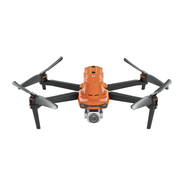
Autel EVO II Pro RTK: Lightweight high-precision drone

Equipped with a 1-inch CMOS sensor, it can take 20MP photos with outstanding image quality
High-precision RTK module, supports PPK post-processing, and achieves centimeter-level positioning accuracy
Lightweight body design, can be deployed by one person, and can be operated quickly
Supports automatic waypoint flight, perfectly adapted to various urban mapping tasks: such as road surveys, building facade modeling, green space renewal, etc.
Autel Robotics EVO II Pro RTK V3 [Including RTK Module]
$2999.00 USD
Autel EVO MAX RTK: Enterprise-level drone mission commander

As a flagship mapping drone, EVO MAX RTK is a heavy-duty, multi-functional "air work platform":
Multi-sensor fusion: (LiDAR, thermal imaging, visible light integration)
Centimeter-level three-frequency RTK system, strong anti-interference ability, suitable for complex urban environments
Intelligent obstacle avoidance and path planning AI engine to ensure mission safety
Equipped with Autel Mapper software, it realizes one-stop orthophoto, DSM, and point cloud data processing

Autel Robotics EVO Max 4T with RTK Module Bundle
$9299.00 USD
Whether it is measuring streets between high-rise buildings, quickly completing post-disaster data collection, or building a digital twin system for smart cities, MAX RTK is a powerful core tool.
Using drones for urban mapping process
Both the Autel EVO II series and the Autel EVO MAX series have high-quality image sensors that can accurately collect spatial surface information. At the same time, the drone supports flight planning, and can set route missions to start automatic photography.
The first step is flight planning - a key step in aerial photogrammetry mapping. To start this step, it is important to determine the area to be surveyed and its boundaries. Other aspects required for planning include determining the boundaries of interest, the camera model to be used, the launch and landing positions, the flight altitude and speed, the number of images and tracks, and the image overlap.
Once the flight plan is ready, the next step is to execute the flight plan: fly the drone over the target area. When performing this step, the first thing to do is to check the battery power of the drone to avoid unexpected problems caused by running out of power. The pilot must fully understand and master the operation of the aircraft and be able to handle the relevant equipment if problems arise during the flight.

When using fixed-wing drones or hybrid-powered drones for mapping, manual launch may be required, and the pilot must follow specific details to launch correctly. After arriving at the airport, it is crucial to analyze weather conditions and other factors that may interfere with the flight plan.
Once the drone is put into operation, it is important that the pilot monitors the flight from the ground using a smartphone or laptop to monitor parameters such as altitude, aircraft speed, wind speed and stability to ensure perfect image collection.
After the planning and data collection phase, these materials are built in software and can be transformed into maps and various products and can be used in cases such as urban and rural registration, engineering control and monitoring, road planning, civil engineering, area and topographic surveys, georeferencing, asset management, environmental impact assessment, etc. in urban areas.

In the case of collecting and generating specific products, data interpretation and analysis must be carried out by professional experts in the field of project use, whether it is civil engineering, architecture, urban planning, environment, etc.
Drone data empowers cities
The data collected by Autel RTK series drones is not only used for map production, but also provides immediate decision support for urban planning departments, emergency management centers, environmental protection agencies, etc. through AI image recognition, automatic modeling, GIS system integration, etc.
Conclusion
Cities are becoming more "smart" and surveying and mapping technology is constantly innovating. From the efficient deployment of EVO II Pro RTK to the all-terrain coverage capability of EVO MAX RTK, Autel Robotics provides reliable and high-performance solutions for the surveying and mapping industry. If you are looking for an accurate and efficient urban aerial photography tool, you might consider these two "aerial mapping experts".


