


How UAV Drones Surveying Achieves Centimeter Level Precision
In the past, traditional surveying often relied on ground survey stations and manual collection, which was inefficient and costly. Today, high-precision UAV surveying has become a new generation of mainstream solutions, especially in scenes such as construction, agriculture, mining, and terrain modeling.
But are you curious: How can a drone flying in the sky accurately measure the ground position to the "centimeter level"? Is it really reliable?
Today we will reveal the key technologies and implementation methods behind it.
What is centimeter-level measurement accuracy?
In the field of geographic surveying, centimeter-level accuracy means: the position error of the measurement point is between ±1 and 5 centimeters.
The photogrammetry technology used by ordinary aerial camera drones has a positioning error of ±1 to 3 meters.
Therefore, the core of modern drone land surveying is high-precision GNSS (RTK/PPK). Land surveyors use RTK drones to meet most high-precision engineering surveying requirements, such as road stakeout, building 3D modeling, volume calculation, etc.

$401 OFF 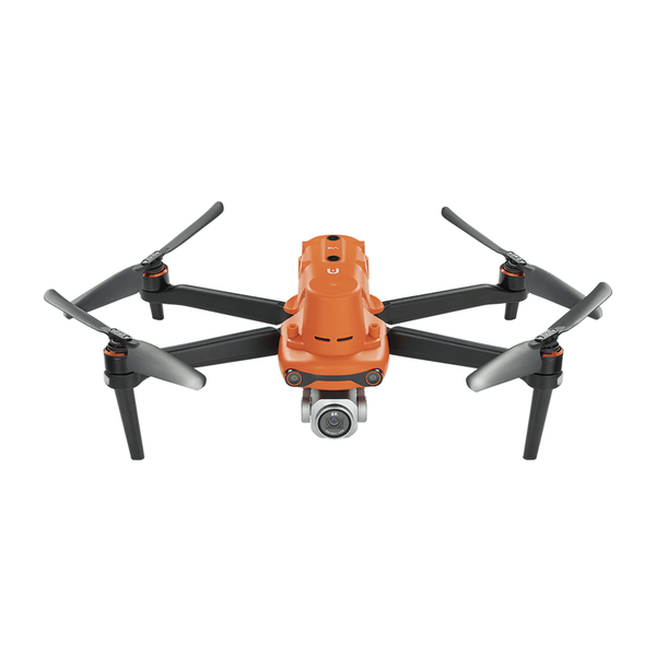
Autel Robotics EVO II Pro RTK V3 [Including RTK Module]
$2999.00 USD
Core technologies for UAV measurement with centimeter-level accuracy
UAVs achieve centimeter-level accuracy by combining RTK/PPK technology, high-resolution cameras, LiDAR, advanced flight control, and professional data processing.
1. RTK (Real-time Kinematic Differential) Technology
RTK is one of the core technologies for UAVs to achieve centimeter-level accuracy. By receiving differential signals from ground base stations or GNSS networks, RTK can correct GPS positioning errors in real time, increasing accuracy from meter level to 1-2 cm. Autel RTK UAVs can achieve horizontal accuracy of about 1 cm + 1 ppm and vertical accuracy of 1.5 cm + 1 ppm.
2. PPK (Post-processing Kinematic Differential) Technology
Unlike RTK, PPK performs differential processing on raw GNSS data through software after flight, and can also achieve centimeter-level accuracy. The advantage of PPK is that it does not require real-time connection to a base station, which is suitable for remote areas or environments with poor signals. Most modern surveying and mapping UAVs support RTK and PPK technologies, maintaining high accuracy in a variety of scenarios.
View More: Drone Mapping: RTK VS PPK VS GCP
3. High-resolution camera and optical zoom
The resolution and lens quality of the camera directly affect the measurement accuracy. Drones equipped with high-resolution sensors and optical zoom (such as Autel EVO Max 4T 8K 10x optical zoom) can capture clearer ground details and generate high-precision point clouds and 3D models. Optical zoom also allows drones to shoot subtle targets at a safe distance, reducing flight risks.
4. LiDAR (laser radar) integration
LiDAR measures the distance of objects by emitting laser pulses, which can generate high-precision 3D point cloud data with centimeter-level accuracy. LiDAR drones are particularly suitable for measuring complex terrain or vegetation-covered areas, such as forest mapping or power line inspection.
5. Flight control, obstacle avoidance and IMU
Terrain mapping often has complex actual scenes and difficult measurements, which requires drones to have powerful performance and be able to fly stably in complex environments. Therefore, if UAVs want to achieve centimeter-level measurement accuracy, they need all-round obstacle avoidance technology, precise flight control systems, and high-precision IMUs to ensure that the UAV remains stable in complex terrain or low visibility conditions and reduce data errors caused by jitter or collision.
6. Ground Control Points (GCPs) and Checkpoints
Ground Control Points (GCPs) are reference points with known coordinates. By arranging GCPs in the survey area and correcting them in combination with UAV images, the measurement accuracy can be further improved. Checkpoints are used to verify data accuracy and ensure that the output results meet centimeter-level standards.
7. Data Processing Software
High-precision measurement is inseparable from post-processing with professional software. UAV mapping software such as Autel Mapper, Pix4D, and Agisoft Metashape can convert images and GNSS data collected by UAVs into high-precision point clouds, DSMs (digital surface models), or orthophotos.
Application Scenarios for Centimeter-Level Accuracy
UAV mapping is an important step in modern land surveying. RTK UAV centimeter-level measurement can be widely used in many fields, helping the UAV mapping industry.
- Mapping and terrain modeling: Generate high-precision topographic maps, DSMs and 3D models to serve urban planning, land surveying, etc.
- Construction and engineering: Monitor construction progress, measure earthwork volume or verify the accuracy of building structures.
- Agricultural management: Accurately measure farmland boundaries, crop heights or irrigation system layouts to optimize resource allocation.
- Infrastructure inspection: Check for subtle defects in bridges, power lines or pipelines to ensure safe operation.
- Environmental monitoring: Monitor coastline erosion, vegetation changes or geological disasters, and provide high-precision data support.

Read More: Low Budget RTK PPK Drone in 2025
Summary
The deep integration of RTK/PPK data and software is the key to achieving centimeter-level accuracy. The realization of centimeter-level precision mapping by drones has opened the door to a new world for the measurement tasks of many engineering projects, fully improved the measurement accuracy and efficiency, and moved towards a new era of intelligent mapping.