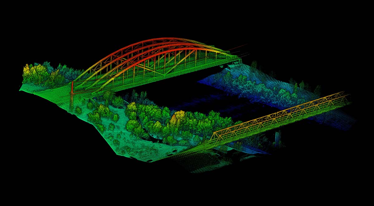
Drone lidar and photogrammetric imaging applications are growing rapidly. LiDAR drones provide new power to the surveying and mapping industry. The use of quadcopters and multirotors in lidar mapping is still in its early stages, and here we illustrate how lidar technology is changing the mapping industry.
What is lidar technology?
Drone lidar involves attaching a laser scanner to a drone to measure the altitude of a midpoint in the landscape beneath the drone. LiDAR actually refers to (Light Detection and Ranging).
The LiDAR UAV is a UAV that uses LiDAR technology for terrain measurement and 3D modeling.
Key Features and Benefits of LiDAR Mapping UAVs
High-precision surveying and mapping: Lidar can quickly and accurately obtain high-precision 3D point cloud data of objects such as the surface and buildings, and can achieve millimeter-level or even higher precision, which is more accurate than traditional surveying and mapping methods.
High efficiency: LiDAR surveying and mapping drones can cover a large area of terrain in a short period of time, quickly process and model the collected data, improve production efficiency, and greatly save time and labor costs.
Wide range of applications: LiDAR mapping UAVs can be applied to different types of sites, such as mountains, forests, cities, waters and other terrains, and are especially valuable for fields that require high-precision maps or modeling data, such as municipal planning , land survey, resource investigation, disaster assessment, etc.
Good visualization effect: 3D point cloud data collected by lidar can produce high-precision 3D models or maps, which are convenient for intuitive display and analysis, and can provide more realistic and clear visualization effects.
High security: Compared with manual measurement or traditional aerial photography, the autonomous flight of lidar mapping drone has higher safety. At the same time, the use of lidar obstacle avoidance technology and multiple protection measures ensures the safety Safe flight and accurate data collection.
The best application field of LiDAR mapping UAV
Almost most sectors benefit from the ability to improve efficiency and reduce costs thanks to the precise 3D images of lidar mapping drones.
These areas include forestry management and planning, flood modeling, pollution modeling, cartography, urban planning, coastline management, transportation planning, oil and gas exploration, quarries and minerals, electrical energy fields, archaeology, and more.
In short, lidar surveying and mapping drones not only improve the efficiency of surveying and mapping, but also provide more accurate data support for architectural planning, urban planning, environmental monitoring and other fields, and have been widely used and welcomed.


