


Autel Robotics EVO II Dual 640T RTK V3 Thermal Drone

Autel Robotics EVO II Dual 640T RTK V3 Thermal Drone
Prime Sales: Get it now for $4,599.00
Discount automatically applied!
- Remote ID Updated
- 7.9" Smart Controller V3
- 15km Image Transmission
- SkyLink 2.0
- 50MP Picture/0.8" CMOS Sensor
- 640*512 Thermal Imaging Resolution
- 10 Thermal Color Palettes
- 360° Obstacle Avoidance
- Dynamic Track 2.1
- 38 Mins Flight Time
Fast Delivered by Fri, Jun 26 - Sun, Jun 28 Free Ship from USA
Fast, Free Shipping & No Extra Tax
30-Day Return or Replacement
12-Month Free Warranty
Lifetime Customer Support

- Overview
- specificatiion
- Package
- Documents
- Faqs
-
EVO II Dual 640T RTK V3
Autel EVO 2 Dual 640T infrared drone is an industry-first drone combining infrared imaging camera with video camera. With thermal resolution up to 640x512 and visible light camera EVO 2 becomes a workhorse. First responders, contractors, and business owners finally have a compact and portable tool that gives them the data they have been asking for.
-

Dual Camera
Thermal | Visual Camera -

Thermal Camera
640*512 Resolution -

50MP
Picture -

15km
Transmission Range -

360°
Obstacle Avoidance -

Carbon Fiber
Arms -

38 Minutes
Flight Time -

7.9"
Smart Controller V3
-
Dual Camera
Thermal | Visual Camera -
Thermal Camera
640*512 Resolution -
50MP
Pictures -
15km
Transmission Range -
360°
Obstacle Avoidance -
Carbon Fiber
Arms -
38 Minutes
Flight Time -
7.9"
Smart Controller V3

640T Thermal Camera
-
-
640*512 High Resolution
The EVO II 640T infrared camera is equipped with a high-resolution 640*512 infrared sensor, allowing for exceptional pixel density to capture more details and thermal information.
-
16x Digital Zoom
EVO II 640T infrared camera boasts a powerful 16x digital zoom capability, enabling users to magnify details without getting close to the target.
-
13mm focal length lens
This well-chosen focal length strikes a balance between target size and detail clarity, allowing users to obtain satisfactory infrared images in different application scenarios.
-

-
-
640*512 High Resolution
The EVO II 640T infrared camera is equipped with a high-resolution 640*512 infrared sensor, allowing for exceptional pixel density to capture more details and thermal information.
-
16x Digital Zoom
EVO II 640T infrared camera boasts a powerful 16x digital zoom capability, enabling users to magnify details without getting close to the target.
-
13mm focal length lens
This well-chosen focal length strikes a balance between target size and detail clarity, allowing users to obtain satisfactory infrared images in different application scenarios.

Multiple Temperature Measurement Modes
-

-
Central, Spot, And Regional Temperature Measurement
EVO II 640T V3 Central temperature measurement: View real-time display of the temperature in the center area of the screen. Spot temperature measurement: Tap the screen, and the temperature of the selected object will be displayed in real time. Regional temperature measurement: Get a dynamic view of the average temperature, maximum temperature, and minimum temperature displayed in a selected area.
-

-
Temperature Alarm And Image Enhancement
Temperature alarm: Monitors the screen temperature in real time. The system prompts the user when the temperature reaches a set threshold. Isotherm: Set a temperature range and the system will detect any objects within the temperature range specified. Image enhancement: Supports real-time adjustment of image brightness, contrast, and image details. The system will highlight any objects within the temperature target.
-
-

-
10 Thermal Color Palettes
White Hot | Cold and Hot | Rainbow | Enhanced Rainbow | Ironbow | Lava | Arctic | Searing | Gradation |Heat Detection
-

-
Picture-in-Picture Display Mode
Visual and thermal imagery of 640T V3 are combined to help users quickly interpret data and aid in critical decision making.
-
-

-
Powerful Infrared Thermal Analysis Tool
IRPC TOOL: This free temperature measurement analysis tool is developed specifically for the 640T Series, and enables users to quickly import images, edit and analyze temperature measurements, and generate detailed reports for sharing and collaboration.
-
-
Central, Spot, And Regional Temperature Measurement
Central temperature measurement: View real-time display of the temperature in the center area of the screen. Spot temperature measurement: Tap the screen, and the temperature of the selected object will be displayed in real time. Regional temperature measurement: Get a dynamic view of the average temperature, maximum temperature, and minimum temperature displayed in a selected area.
-
-
10 Thermal Color Palettes
White Hot | Cold and Hot | Rainbow | Enhanced Rainbow | Ironbow | Lava | Arctic | Searing | Gradation |Heat Detection
-
-
Picture-in-Picture Display Mode
Visual and thermal imagery are combined to help users quickly interpret data and aid in critical decision making.
-
-
Temperature Alarm With Isotherm And Image Enhancement
Temperature alarm: Monitors the screen temperature in real time. The system prompts the user when the temperature reaches a set threshold. Isotherm: Set a temperature range and the system will detect any objects within the temperature range specified. Image enhancement: Supports real-time adjustment of image brightness, contrast, and image details. The system will highlight any objects within the temperature target.
-
-
Powerful Infrared Thermal Analysis Tool
IRPC TOOL: This free temperature measurement analysis tool is developed specifically for the 640T, and enables users to quickly import images, edit and analyze temperature measurements, and generate detailed reports for sharing and collaboration.
50MP Ultra-Sensitive Camera
The EVO II Dual 640T V3's RYYB sensor features the Moonlight Algorithm 2.0 that provides excellent noise reduction in limited lighting conditions, further enhancing its 50 megapixel camera to give users more detail for better forensics and analysis.

-
-
0.8" Sensor Size
The EVO II Dual 640T V3's 0.8" RYYB CMOS offers up to 144%~233% more surface area when compared to 1/2" or 1/2.3" competitors for maximum details in high-contrast lighting conditions.
-
RYYB Sensor Technology
RYYB sensor technology moves away from RGB cameras by offering up to 40% more light sensitivity in low light scenarios.
-
PDAF+CDAF Autofocus System
Never lose sights of your subjects with a combination of PDAF (Phase Detection Auto Focus) and CDAF (Contrast Detection Auto Focus) technology for fast and accurate tracking.
-
-
-
0.8" Sensor Size
The EVO II Dual 640T V3's 0.8" RYYB CMOS offers up to 144%~233% more surface area when compared to 1/2" or 1/2.3" competitors for maximum details in high-contrast lighting conditions.
-
RYYB Sensor Technology
RYYB sensor technology moves away from RGB cameras by offering up to 40% more light sensitivity in low light scenarios.
-
PDAF+CDAF Autofocus System
Never lose sights of your subjects with a combination of PDAF (Phase Detection Auto Focus) and CDAF (Contrast Detection Auto Focus) technology for fast and accurate tracking.
-
-

-
Get The Full Scene
The system supports 16x digital zoom and 4x lossless zoom, providing long-distance image acquisition and detailed insight into scenes safely.providing long-distance image acquisition and detailed insig
-

-
4K HDR for Greater Dynamic Range
4K HDR automatically balances overexposure and underexposure when shooting scenes with too much contrast, producing clearer images with more layers.
-
-
Get The Full Scene
The system supports 16x digital zoom and 4x lossless zoom, providing long-distance image acquisition and detailed insight into scenes safely.
-
-
4K HDR for Greater Dynamic Range
4K HDR automatically balances overexposure and underexposure when shooting scenes with too much contrast, producing clearer images with more layers.
Centimeter-Level Positioning
Autel Robtoics EVO II Dual 640T RTK V3 introduces a brand-new RTK module, which provides real-time centimeter-level positioning data, and supports Post-Processing Kinematic (PPK). The aircraft can record the original satellite observation data, camera exposure parameters and more. The positioning system supports an RTK base station and NTRIP RTK network, which help to achieve accurate and stable data acquisition in complex operation environments.

Autel Robtoics EVO II Dual 640T RTK V3 introduces a brand-new RTK module, which provides real-time centimeter-level positioning data, and supports Post-Processing Kinematic (PPK). The aircraft can record the original satellite observation data, camera exposure parameters and more. The positioning system supports an RTK base station and NTRIP RTK network, which help to achieve accurate and stable data acquisition in complex operation environments.
-

-
RTK Horizontal Positioning Accuracy: 1cm+1ppm
-

-
RTK Vertical Positioning Accuracy: 1.5cm+1ppm
-
-
No GCP Required
Dual 640T RTK V3 can connect to an NTRIP network and does not need GCPs to provide centimeter-grade accuracy.

-
-
-
3rd Party Base Station Support
EVO II Dual 640T RTK Series V3 supports all NTRIP-compatible base stations.

-
-
-
No GCP Required
Dual 640T RTK V3 can connect to an NTRIP network and does not need GCPs to provide centimeter-grade accuracy.
-
-
-
3rd Party Base Station Support
EVO II Dual 640T RTK Series V3 supports all NTRIP-compatible base stations.
-
Autel Explorer For Mapping
-
-

-
Multi-NTRIP Profile Saving
For repeatable data acquisition missions, you can record the drone's previous shooting positions. All the gimbals, camera, and aircraft movements will be replicated, thus producing a full record of the entire mission.
-

-
Photo Replication
For repeatable missions, you can record the drone's previous shooting parameters. The gimbal, camera, and movement settings will be replicated, allowing missions to be easily duplicated.
-

-
Multi-Battery Missions
The Explorer App allows the user to create and save multiple NTRIP profiles for different locations, so they don't have to manually input new a flight plan for every new location.
-

-
-
-
Multi-NTRIP Profile Saving
For repeatable data acquisition missions, you can record the drone's previous shooting positions. All the gimbals, camera, and aircraft movements will be replicated, thus producing a full record of the entire mission.
-
-
Photo Replication
For repeatable missions, you can record the drone's previous shooting parameters. The gimbal, camera, and movement settings will be replicated, allowing missions to be easily duplicated.
-
-
Multi-Battery Missions
The Explorer App allows the user to create and save multiple NTRIP profiles for different locations, so they don't have to manually input new a flight plan for every new location.
-
Autel SkyLink 2.0 Video Transmission
SkyLink 2.0 is built into the EVO II Dual 640T V3 chipset, expanding the possibilities for your most critical workflows.
-
9+ Miles Do more because you can fly further away
-
QHD Incredible video resolution within a mile, meeting most common use cases.
-
2.4GHz / 5.8GHz / 900MHz Supports tri-band communication with automatic frequency hopping for maximum anti-interference capabilities.
-
* 900MHz is only applicable for FCC countries.

-
9+ Miles
Do more because you can fly further away.
-
QHD
Incredible video resolution within a mile, meeting most common use cases.
-
2.4GHz / 5.8GHz / 900MHz
Supports tri-band communication with automatic frequency hopping for maximum anti-interference capabilities.
-
* 900MHz is only applicable for FCC countries.
360° Obstacle Avoidance
Autel Robotics EVO II Dual 640T V3 is equipped with 19 groups of sensors including 12 visual sensors,the main camera, ultrasound, IMUs and other sensors enable building of three-dimensional maps and path planning in real time.
EVO II - AI Enhanced Dynamic Track
EVO II Dual smart tracking uses deep learning algorithms to automatically track the selected subject while avoiding obstacles during flight. The function can track the subject in three modes: behind, side-by-side, or fixed position.
Auto go home & Accurate Landing
EVO 2 Dual 640T V3 will return home automatically when Low Aircraft Battery Level and Communication Lost. Additionally, EVO 2’s bottom binocular vision camera to create a density depth map. Then, it calculates the depth map's flatness and angles to ensure an accurate and safe landing.
-
ATH(Auto Reture Home) -
Hover -
Land Off
-
ATH(Auto Reture Home) -
Hover -
Land Off
Industry Leading Performance
-
38 minutes
Maximum Flight
Time -
9.3 miles (15km)
Maximum Transmission
Range -
27 mph (12m/s)
Maximum Wind
Resistance -
45 mph (20m/s)
Maximum Flight
Speed -
2 lbs (920g)
Maximum Lift
Capability

-
38 minutes
Maximum
FlightTime -
9.3 miles (15km)
Maximum Transmission Range
-
27 mph (12m/s)
Maximum
Wind Resistance -
45 mph (20m/s)
Maximum
Flight Speed -
2 lbs
(920g)Maximum
Lift Capability

Autel Smart Controller V3
Smart Controller V3's 7.9-inch, 2000 nit high-brightness screen is clearly visible even under direct sunlight. SkyLink 2.0 Transmission technology guarantees long-distance operations from up to 9 miles away and enhances anti-interference abilities with triple-band frequency hopping. The customized Android system allows for additional flexibility with 3rd party apps and an IP43 rating ensures all weather performance.
-
-

- 7.9-Inch HD Touch Screen
-

- -4 °F to 104 °F Temperature Range
-

- 2000 nits Maximum Brightness
-

- IP43 Resistance
-

-
-
7.9-Inch
HD Touch Screen
-
-
-4 °F to 104 °F
Temperature Range
-
-
2000 nit
Maximum Brightness
-
-
IP43
Resistance
Thermal Imaging Function
-
Picture-in-Picture Mode
Visual and thermal imagery are combined to help users quickly interpret data and critical decision making. From top to bottom are "Picture in Picture Mode", "infraed More", and "visible Light Mode"

-
Spot Temperature Measurement
Tap the screen, and the temperature of the selected object will be displayed in real time.
-
Regional Temperature Measurement
Get a dynamic view of the average temperature, maximum temperature, and minimum temperature displayed in a selected area.
The temperature measurement frame can be dragged to any position on the screen.

-
Temperature Warning
Monitors the screen temperature in real time. The system prompts the user when the temperature reaches a set thresholds
Note: The temperature alarm takes effects only in Regional temperature measurement mode
10 Thermal Color Palettes
White Hot | Cold and Hot | Rainbow | Enhanced Rainbow | Iron bow | Lava | Arctic | Searing | Gradation | Heat Detection

-
Picture-in-Picture Mode
Visual and thermal imagery are combined to help users quickly interpret data and critical decision making. From top to bottom are "Picture in Picture Mode", "infraed More", and "visible Light Mode"
-
Spot Temperature Measurement
Tap the screen, and the temperature of the selected object will be displayed in real time.
-
Regional Temperature Measurement
Get a dynamic view of the average temperature, maximum temperature, and minimum temperature displayed in a selected area.
The temperature measurement frame can be dragged to any position on the screen.
-
Temperature Warning
Monitors the screen temperature in real time. The system prompts the user when the temperature reaches a set thresholds
Note: The temperature alarm takes effects only in Regional temperature measurement mode
-
10 Thermal Color Palettes
White Hot | Cold and Hot | Rainbow | Enhanced Rainbow | Iron bow | Lava | Arctic | Searing | Gradation | Heat Detection

Autel EVO II Dual 640T RTK Rugged Bundle V3 Package List

Autel EVO II Dual 640T RTK Enterprise Bundle V3 Package List

-
-
Professional Drone Technical Specifications
Explore detailed specifications for aircraft performance, imaging systems, thermal capabilities, autonomy, radar systems, controller hardware, and more.
Weight 1209g Maximum takeoff weight 1270 g (C2) Dimensions Folded: 230×130×108mm
Unfolded: 457×558×108mmMax. rotation speed 9000 rpm Wheelbase 397 mm Maximum ascent speed Novice mode:3 m/s
Standard: 5m/s
Ludicrous: 8 m/sMaximum descent speed Novice mode: 3 m/s
Standard: 3 m/s
Ludicrous: 4 m/sMaximum horizontal flight speed (no wind near sea level) Novice mode: 3 m/s
Standard: 10 m/s
Ludicrous: 20 m/sMaximum Service Ceiling Above Sea Level 5000 meters Maximum flight altitude 800 meters (Altitude limit in the App) Maximum flight time (no wind) 38 minutes Maximum range 25 km Maximum flight distance (no wind) 22 km Maximum hover time (no wind) 33 minutes Maximum Wind Speed Resistance Takeoff and Landing Phase: 10.7 m/s
Cruise Phase: 12 m/sMaximum tilt angle Novice mode: 15°
Standard: 30°
Ludicrous: 33°Maximum rotation angular speed 120°/s Working temperature -10~40℃ Battery hot replacement not support Internal storage Onboard storage: 8GB GNSS GPS/Galileo/BeiDou/GLONASS Hover accuracy Vertically:
±0.1 meters (when visual positioning is working normally)
±0.5 meters ( when GNSS is working normally)
Horizontally:
±0. 3 meters (when visual positioning is working normally)
± 1.5 meters ( when GNSS is working normally )Mechanical scope Pitch: -135° to +45°
Heading: -100° to +100°Controllable rotation range Pitch: -90° to +30°
Heading: -90° to +90°Stable system Three-axis stabilization Maximum control speed (pitch) 300°/s Angualr vibration range 0.005° Thermal Imager Uncooled VOx Microbolometer Lens FOV H33°V26°
Focal length 13mmZoom 1-16x Pixel size 12μm Wavelength range 8 - 14μm Temperature range High gain mode: -20° to +150°
Low gain mode: 0° to +550°Temperature measurement accuracy ±3℃ or ±3% of reading (whichever is greater)
@Environmental temperature-20℃~60℃Accurate temperature measurement distance 2-20 meters Video resolution 640x512@25fps Video format MOV / MP4 (Support H.264/H.265) Camera resolution Infrared mode: 640*512
Picture-in-picture mode: 1920*1080, 1280*720Photo mode Single shot
Burst shooting: 3/5 frames, 3 is the default
Time Lapse: JPG: 2s/5s/7s/10s/20s/30s/60sPhoto format JPG (with irg file) Image sensor 1/1.28 inch CMOS, 50 million pixels Lens Field of view: 85°
35 mm format equivalent focal length: 23 mm
Aperture: f/1.9
Focus distance: 0.5 meter ~ ∞ISO range Video: ISO100 ~ ISO6400
Photo: ISO100 ~ ISO6400
Night scene mode: Maximum video ISO320000Shutter speed Photo mode: 1/8000 ~ 8 seconds
Others: 1/8000 ~ 1/frame rate secondZoom 1 - 16x digital zoom (maximum 4x lossless zoom) Maximum photo size 8192×6144(4:3)
4096×3072(4:3)
3840×2160(16:9)Photo format JPG (default) /12bits DNG / JPG+12bits DNG Photo shooting mode Single shooting (default)/Brust shooting/AEB continuous shooting/time lapse/HDR shooting Video resolution 3840×2160 P60/P50/P48/P30(Default)/P25/P24
2720×1528 P60/P50/P48/P30/P25/P24
1920×1080 P120/P60/P50/P48/P30/P25/P24Video format MP4 / MOV (MPEG-4 AVC/H.264, HEVC/H.265) Video maximum bit rate 60Mbps Support file system FAT32/exFAT Antenna Dual antennas, 1T2R, detachable design Operating Frequency 900M: 902-928MHz*
2.4G: 2.400–2.476GHz**, 2.400–2.4835GHz
5.8G: 5.725-5.829GHz**, 5.725-5.850GHz
* Only applicable to FCC and ISED regions.
** Only applicable to SRRC region.
Note: Some frequencies are only applicable in some regions or only used in door. For details, please refer to local laws and regulations.Effective Isotropic Radiated Power (EIRP) 900M:
≤30dBm(FCC/ISED)
2.4G:
≤30dBm(FCC/ISED); ≤20dBm (CE/SRRC/UKCA)
5.8G:
≤30dBm(FCC/ISED/SRRC); ≤14dBm (CE/UKCA)Maximum Transmission Distance
(Without Interference and Blocking)FCC: 15 km
CE/SRRC: 8 kmSensing range Forward: 0.5~18 meters
Effective sensing speed:<12m/s
Backward: 0.5~16 meters
Effective sensing speed:<12m/s
Left and right: 0.5~10 meters
Effective sensing speed:<5m/s
Upward: 0.5~10 meters
Effective sensing speed:<5m/s
Downward: 0.5~10 meters
Effective sensing speed:<5m/sFOV Forward and backward:
60° horizontally, 80° vertically
Upward:
65° horizontally, 50° vertically
Left and right:
65° horizontally, 50° vertically
Downward:
100° horizontally, 80° verticallyEffective use of the environment Front, rear, left and right:The surface has rich texture and sufficient lighting conditions ( >15 lux, normal indoor fluorescent lighting environment)
Above: The surface is a diffuse reflection material and the reflectivity is >20% (such as walls, trees, people, etc.)
Below: The ground is richly textured and the lighting conditions are sufficient ( >15 lux, normal indoor fluorescent lighting environment) The surface is made of diffuse reflective material and the reflectivity is >20% (such as walls, trees, people, etc.)Type TFT LCD Dimensions 7.9 inches Maximum Brightness 2000 nits Resolution 2048×1536 Refresh Rate 60Hz Touch Control Supports 10-point touch Material PC+ABS Dimensions 269×189×87 mm (antennas folded horizontally)
269×189×173 mm (antennas folded vertically)
269×302×87 mm (antennas unfolded horizontally)Weight 1194 g (protective case excluded)
1365 g (protective case included)Operating Temperature -20℃ to 40℃ Storage Temperature +15℃ ~ +25℃ (within a year)
0℃ ~ +30℃ (within three months)
-20℃ ~ +45℃ (within a month)Protection Rating IP43 Internal Storage 128GB microSD Extension Not supported Operating System Based on Android 11 Application Installation Supports the installation of third-party Android apps Video Performance 4K@24FPS H.264/H.265 video smooth play HDMI Outputs up to 1080P@60FPS video USB-C Charging: supports PD/QC fast charging, up to 65W
Data: USB3.1 Gen2USB-A Charging: 5V/2A
Data: USB2.0GNSS GPS+Galileo+BeiDou+GLONASS Wi-Fi Protocol 802.11a/b/g/n/ac
Supports 2×2 MIMO Wi-FiWi-Fi Operating Frequency 2.4G: 2.400 – 2.476GHz*, 2.400 – 2.4835 GHz
5.1G: 5.15 - 5.25 GHz**
5.8G: 5.725 - 5.829GHz*, 5.725 - 5.850 GHz
* Only applicable to SRRC regions.
** Only applicable to MIC regions.
Note: Some frequencies are only available in some regions or for indoor use only. Check local laws and regulations for details.Wi-Fi Effective Isotropic Radiated Power (EIRP) 2.4G:
≤30dBm (FCC), ≤20dBm (CE/SRRC)
5.1G:
≤10mW (MIC)
5.8G:
≤33dBm (SRRC), ≤30dBm (FCC), ≤14dBm (CE)Bluetooth Bluetooth 5.0 Bluetooth Operating Frequency 2.400 - 2.4835 GHz
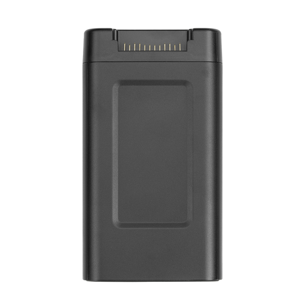
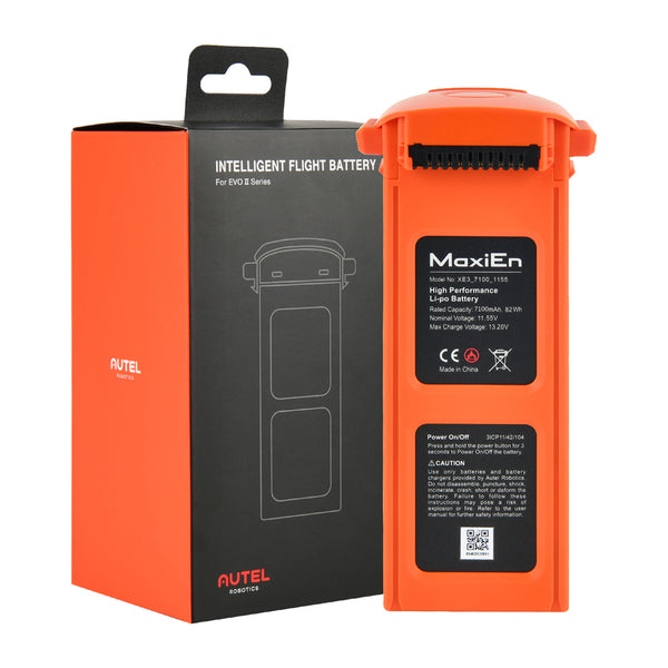
Note: Some regions have designated frequency ranges. Check local laws and regulations for details.Bluetooth Effective Isotropic Radiated Power (EIRP) ≤20dBm (SRRC/CE), ≤21dBm (CE) Operating Temperature 0~+45℃ Battery Type LiPo 3S Rated Capacity 7100 mAh Battery energy 82 Wh Voltage 11.55 V Charging Voltage Limit 13.2V Rated Charging Power 66W Maximum charging power 93W Weight 365g Battery charging temperature +5-+45℃
(When the battery temperature is below 5℃, the battery stops charging. When the battery temperature is above +45℃, the battery stops charging.) -
Autel EVO II Dual 640T RTK Rugged Bundle V3 Package List
Autel EVO II Dual 640T RTK Enterprise Bundle V3 Package List
-
Autel Robotics EVO II RTK Series Quick Questions & Quick Answers
Q: What is the main difference between RTK series products and other EVO II series products?
Q: What is the effective image transmission range of the RTK Series?
Q: In real-time mapping, can the aircraft continue mapping while the image transmission signal is lost?
Q: What is the screen size and resolution of the remote controller?
Q: Which RTK base station modes are currently supported?
Q: What is the RTK positioning accuracy?
Q: What is the difference between PPK and RTK mode and how to choose?
Q: Does the EVO II RTK series provide measurements in relative coordinates or absolute coordinates?
Q: Does the aircraft support lossless zoom?


Deliver to
Deliver to
Free Fast Arrival by: -


