



Autel Robotics EVO II Pro RTK V3

Autel Robotics EVO II Pro RTK V3
- Including RTK Module
- Remote ID Updated
- Centimeter-Level Positioning
- Support PPK
- NTRIP RTK Network
- Flight Profiles Save
- Rectangular or Polygon Missions
- 1" CMOS Sensor Gimbal Camera
- 360° Obstacle Avoidance
- 38 Minutes Flight Time
- 10km Video Transmission Range
Fast Delivered by Thu, May 28 - Sat, May 30 Free Ship from USA
Fast, Free Shipping & No Extra Tax
30-Day Return or Replacement
12-Month Free Warranty
Lifetime Customer Support

- Overview
- Specification
- Package
- Documents
- Faqs
-
Autel EVO II Pro RTK V3
Autel EVO 2 Pro RTK V3 is an advanced drone model that offers an impressive range of features designed for surveying and mapping applications. This drone is equipped with advanced RTK technology that allows it to achieve highly accurate positioning with an accuracy of up to 1cm+1ppm (1.5cm+1ppm). This makes it ideal for use in a wide range of industries, including construction, agriculture, and mining.


Centimeter-Level Positioning
Autel EVO II RTK Series V3 introduces a brand-new RTK module, which provides real-time centimeter-level positioning data, and supports Post-Processing Kinematic (PPK). The aircraft can record the original satellite observation data, camera exposure parameters and more. The positioning system supports an RTK base station and NTRIP RTK network, which help to achieve accurate and stable data acquisition in complex operation environments.


-
-
No GCP Required
EVO II RTK Series V3 can connect to an NTRIP network and does not need GCPs to provide centimeter-grade accuracy.

-
-
-
3rd Party Base Station Support
EVO II RTK Series V3 supports all NTRIP-compatible base stations.

-
-
-
No GCP Required
EVO II RTK Series V3 can connect to an NTRIP network and does not need GCPs to provide centimeter-grade accuracy.
-
-
-
3rd Party Base Station Support
EVO II RTK Series V3 supports all NTRIP-compatible base stations.
-
Autel Explorer For Mapping
-
-

-
Multi-NTRIP Profile Saving
For repeatable data acquisition missions, you can record the drone's previous shooting positions. All the gimbals, camera, and aircraft movements will be replicated, thus producing a full record of the entire mission.
-

-
Photo Replication
For repeatable missions, you can record the drone's previous shooting parameters. The gimbal, camera, and movement settings will be replicated, allowing missions to be easily duplicated.
-

-
Multi-Battery Missions
The Explorer App allows the user to create and save multiple NTRIP profiles for different locations, so they don't have to manually input new a flight plan for every new location.
-

-
-
-
Multi-NTRIP Profile Saving For repeatable data acquisition missions, you can record the drone's previous shooting positions. All the gimbals, camera, and aircraft movements will be replicated, thus producing a full record of the entire mission.
-
-
Photo Replication For repeatable missions, you can record the drone's previous shooting parameters. The gimbal, camera, and movement settings will be replicated, allowing missions to be easily duplicated.
-
-
Multi-Battery Missions The Explorer App allows the user to create and save multiple NTRIP profiles for different locations, so they don't have to manually input new a flight plan for every new location.
-
Advanced Feature Sets
-

Create Rectangular or Polygon Missions -

Supports Double grid mapping for additional angle customizable -

Have complete manual control over camera settings -

Non stop turning on corners saves time and battery life -

Customizable course headings to meet orientation requirements
Autel Mapper - Reveal The Full Picture.
-
Real-time 2D
During flight, the remote controller streams real-time images to Autel Mapper for real-time 2D stitching. Advanced image processing algorithms are used to generate high-precision 2D orthophoto images in real time, providing the on-site operators with a basis for adjusting the workflow in a timely manner.
-
Real-time 2D
During flight, the remote controller streams real-time images to Autel Mapper for real-time 2D stitching. Advanced image processing algorithms are used to generate high-precision 2D orthophoto images in real time, providing the on-site operators with a basis for adjusting the workflow in a timely manner.
-
Swift and Accurate
Autel's AI deep-learning algorithms make Autel Mapper the one of the quickest map processing software in the industry, providing highly accurate 2D and 3D reconstruction, even for small objects - for unbeatable models and maps.

-
3D Reconstruction
Autel Mapper combines traditional and deep learning algorithms to greatly improve the completeness of 3D models. Reconstruction quality can be selected from three options: high, medium, and low. It can reconstruct small objects completely and meet the needs of various industries.

-
2D Reconstruction
Autel's deep learning technology enables autonomous adaptation of AI algorithms in different scenarios, meeting the 1:500 precision requirement in the surveying and mapping industry without GCPs.

Capture Every Detail-EVO II RTK V3
EVO II Pro RTK V3 takes aerial imaging to the next level with its advanced high dynamic range (HDR) capabilities and superior low-light performance. Whether you're flying during the day or at dusk, this drone ensures exceptional image clarity, allowing users to capture intricate details with remarkable precision.

-
-
1-Inch Ultra-Sensitive Sensor
Autel EVO II Pro RTK V3 comes with a NEW updated 1-inch 6K CMOS image sensor with a maximum of 20 megapixels. Thanks to the ultra-sensitive algorithm, you can still shoot clean, detailed, low-noise data sets under twilight or night conditions.
-
f/2.8 ~ f/11 Adjustable Aperture
Adapt to lighting changes by adjusting the lens aperture size, giving the pilot more shutter speed control.
-
-
-
1-Inch Ultra-Sensitive Sensor
Autel EVO II Pro RTK V3 comes with a NEW updated 1-inch 6K CMOS image sensor with a maximum of 20 megapixels. Thanks to the ultra-sensitive algorithm, you can still shoot clean, detailed, low-noise data sets under twilight or night conditions.
-
f/2.8 ~ f/11 Adjustable Aperture
Adapt to lighting changes by adjusting the lens aperture size, giving the pilot more shutter speed control.
-
-
Zoom In For The Details
EVO II Pro RTK V3 is equipped with a powerful camera system that can use the zoom function to allow users to obtain higher details when shooting (zoom up tp 16x), whether it is shooting a wide landscape or in tasks that require precise details, such as mapping, inspection, etc.


-
Optimized For Software Image Correction
EVO II Pro RTK V3 is designed with precision in mind, offering optimized datasets that can be effortlessly adjusted and corrected using post-processing software applications. With advanced image correction capabilities, users can fine-tune every detail, ensuring that images are sharp, accurate, and free from distortions
-
Zoom In For The Details
EVO II Pro RTK V3 is equipped with a powerful camera system that can use the zoom function to allow users to obtain higher details when shooting (zoom up tp 16x), whether it is shooting a wide landscape or in tasks that require precise details, such as mapping, inspection, etc.
-
Optimized For Software Image Correction
EVO II Pro RTK V3 is designed with precision in mind, offering optimized datasets that can be effortlessly adjusted and corrected using post-processing software applications. With advanced image correction capabilities, users can fine-tune every detail, ensuring that images are sharp, accurate, and free from distortions
360° Obstacle Avoidance
EVO 2 Pro RTK V3 is equipped with an advanced 360° obstacle avoidance system, featuring 19 groups of sensors, including 12 visual sensors, the **main camera, ultrasonic sensors, and IMUs (Inertial Measurement Units). These sensors work together to provide comprehensive environmental awareness, ensuring the drone can detect obstacles in every direction, even in complex and dynamic environments.

Mission Planner
Rectangular and Polygon mission planners - Those are going to be great for anybody that's dealing with photogrammetry. So anybody that needs to be able to capture a lot of images in a rectangular mission or polygon mission, you're going to be able to do that in an autonomous fashion. Then you're going to be able to take EVO II Pro RTK V3's images and upload them to your 3D mapping
-
Rectangular Mission 
-
Polygon Mission 
-
Rectangular Mission
-
Polygon Mission
Autel SkyLink 2.0 Video Transmission
SkyLink 2.0, integrated into Autel EVO II RTK V3 chipset, significantly enhances your operational potential. It offers a 9+ mil* range, allowing you to tackle long-distance tasks with confidence. The QHD resolution provides exceptional video quality within a mile, ideal for professional imaging.
-
9+ Miles
Do more because you can fly further away.
-
QHD
Incredible video resolution within a mile, meeting most common use cases.
-
2.4GHz / 5.8GHz / 900MHz
Supports tri-band communication with automatic frequency hopping for maximum anti-interference capabilities.
-
* 900MHz is only applicable for FCC countries.

-
9+ Miles Do more because you can fly further away.
-
QHD Incredible video resolution within a mile, meeting most common use cases.
-
2.4GHz / 5.8GHz / 900MHz Supports tri-band communication with automatic frequency hopping for maximum anti-interference capabilities.
-
* 900MHz is only applicable for FCC countries.

Portable and Easy to Use
-

-
Compact Design
Autel EVO II RTK Series V3 folds up for ease of transport and deployment.
-

-
Trouble Free Daily Workflows
Autel EVO II RTK Series V3 only takes 45 seconds from setup to takeoff.
-
-
Compact Design Autel EVO II RTK Series V3 folds up for ease of transport and deployment.
-
-
Trouble Free Daily Workflows Autel EVO II RTK Series V3 only takes 45 seconds from setup to takeoff.

*Please refer to the manual for details on obstacle avoidance and its limitations, which may or may not work in limited lighting environments, under direct strong sunlight, or across thin tree branches or wires.
Safe and Sturdy
-
38minutes
Maximum Flight Time
-
6.3miles (10km)
Maximum Transmission Range
-
27mph (12m/s)
Maximum Wind Resistance
-
45mph (20m/s)
Maximum Flight Speed
-
38minutes
Maximum
Flight Time -
6.3miles (10km)
Maximum Transmission Range
-
27mph (12m/s)
Maximum Wind Resistance
-
45mph (20m/s)
Maximum Flight
Speed

*Please fly safely and consult your local laws and regulations. Autel Robotics is not liable for any unauthorized flights.
**It’s required to update the latest firmware and app to enjoy comprehensive warranty. More information please refer to warranty policy.
Autel Smart Controller V3
Smart Controller V3's 7.9-inch, 2000 nit high-brightness screen is clearly visible even under direct sunlight. SkyLink 2.0 Transmission technology guarantees long-distance operations from up to 9 miles away and enhances anti-interference abilities with triple-band frequency hopping. The customized Android system allows for additional flexibility with 3rd party apps and an IP43 rating ensures all weather performance.
-
-

- 7.9-Inch HD Touch Screen
-

- -4 °F to 104 °F Temperature Range
-

- 2000 nits Maximum Brightness
-

- IP43 Resistance
-

-
-
7.9-Inch HD Touch Screen
-
-
-4 °F to 104 °F Temperature Range
-
-
2000 nits Maximum Brightness
-
-
IP43
Resistance
Autel EVO II Pro RTK V3 Package List

Autel EVO II Pro RTK V3 Enterprise Bundle Package List

-
-
Professional Drone Technical Specifications
Weight (With propellers, battery) EVO II Pro RTK V3: 1237 g
EVO II Dual 640T RTK V3: 1250 gMaximum takeoff weight EVO II Pro RTK V3: 1270 g (C2)
EVO II Dual 640T RTK V3: 1270 g (C2)Dimensions Folded: 230×130×143 mm
Unfolded: 457×558×143 mmMax. rotation speed 9000 rpm Wheelbase 397 mm Maximum ascent speed Novice mode: 3 m/s
Standard: 5 m/s
Ludicrous: 8 m/sMaximum descent speed Novice mode: 3 m/s
Standard: 3 m/s
Ludicrous: 4 m/sMaximum horizontal flight speed (no wind near sea level) Novice mode: 3 m/s
Standard: 10 m/s
Ludicrous: 20 m/sMaximum Service Ceiling Above Sea Level 5000 meters Maximum flight altitude 800 meters (Altitude limit in the App) Maximum flight time (no wind) 38 minutes Maximum range 25 km Maximum hover time (no wind) 32 minutes Maximum Wind Speed Resistance Takeoff and Landing Phase: 10.7 m/s
Cruise Phase: 12 m/sMaximum tilt angle Novice mode: 15°
Standard: 30°
Ludicrous: 33°Maximum rotation angular speed 120°/s Working temperature -10~40℃ Battery hot replacement Not supported Internal storage Onboard storage: 8GB (Supports microSD card up to 256GB) GNSS GPS/Galileo/BeiDou/GLONASS Hover accuracy Vertically:
±0.1 m (visual positioning)
±0.5 m (GNSS)
Horizontally:
±0.3 m (visual positioning)
±1.5 m (GNSS)Mechanical scope Pitch: -135° to +45°
Heading: -100° to +100°Controllable rotation range Pitch: -90° to +30°
Heading: -90° to +90°Stable system Three-axis stabilization Maximum control speed (pitch) 300°/s Angualr vibration range 0.005° RTK module Dimensions:55.5×72.5×57 mm
Weight:59.5 g
Connections:Floating Connectors
Power:~ 3W
RTK Positioning Precision:
1.5 cm + 1 ppm((Vertical)
1 cm + 1 ppm(Horizontal)Image sensor 1 inch CMOS, 20 million pixels Lens Field of view: 82°
35 mm format equivalent focal length: 29 mm
Aperture: f/2.8-f/11
Focus distance: 0.5 meter ~ ∞ISO range Video: ISO100 ~ ISO6400
Photo: ISO100 ~ ISO6400
Night scene mode: Maximum video ISO44000Shutter speed Photo mode: 1/8000 ~ 8 seconds
Others: 1/8000 ~ 1/frame rate secondZoom 1 - 16x digital zoom (maximum 3x lossless zoom) Maximum photo size 5472×3648 (3:2)
5472×3076 (16:9)
3840×2160 (16:9)Photo format JPG (default) / 12bits DNG / JPG+12bits DNG Photo shooting mode Single shooting (default) / Burst shooting / AEB continuous shooting / time lapse / HDR shooting Video resolution 5472×3076 P30/P25/P24
3840×2160 P60/P50/P48/P30/P25/P24
2720×1528 P60/P50/P48/P30/P25/P24
1920×1080 P120/P60/P50/P48/P30/P25/P24Video format MP4 / MOV (MPEG-4 AVC/H.264, HEVC/H.265) Video maximum bit rate 120Mbps Support file system FAT32/exFAT Operating Frequency 900M: 902 – 928 MHz*
2.4G: 2.400 – 2.476GHz**, 2.400 – 2.4835 GHz
5.2G: 5.15 - 5.25GHz***
5.8G: 5.725 - 5.829GHz**, 5.725 - 5.850 GHz
* Only applicable to FCC and ISED regions.
** Only applicable to SRRC regions.
*** Only applicable to FCC regions.
Note: Some frequencies are only available in some regions or for indoor use only. Check local laws and regulations for details.Maximum signal effective distance (No interference, no obstruction) FCC: 10 kilometers
CE: 8 kilometersEffective transmitter power (EIRP) 900M:
≤30dBm (FCC/ISED)
2.4G:
≤30dBm (FCC/ISED), ≤20dBm (CE/SRRC/UKCA)
5.2G:
≤30dBm (FCC)
5.8G:
≤30dBm (FCC/ISED/SRRC), ≤14dBm (CE/UKCA)Sensing range Forward: 0.5~18 meters
Effective sensing speed: <12m/s
Backward: 0.5~16 meters
Effective sensing speed: <12m/s
Left and right: 0.5~10 meters
Effective sensing speed: <5m/s
Upward: 0.5~10 meters
Effective sensing speed: <5m/s
Downward: 0.5~10 meters
Effective sensing speed: <5m/sFOV Forward and backward:
60° horizontally, 80° vertically
Upward:
65° horizontally, 50° vertically
Left and right:
65° horizontally, 50° vertically
Downward:
100° horizontally, 80° verticallyEffective use of the environment Front, rear, left and right: The surface has rich texture and sufficient lighting conditions (>15 lux, normal indoor fluorescent lighting environment)
Above: The surface is a diffuse reflection material and the reflectivity is >20% (such as walls, trees, people, etc.)
Below: The ground is richly textured and the lighting conditions are sufficient (>15 lux, normal indoor fluorescent lighting environment). The surface is made of diffuse reflective material and the reflectivity is >20% (such as walls, trees, people, etc.)Material PC+ABS Dimensions 269×189×87 mm (antennas folded horizontally)
269×189×173 mm (antennas folded vertically)
269×302×87 mm (antennas unfolded horizontally)Weight 1194 g (without protective case)
1365 g (with protective case)Operating Temperature -20°C to 40°C Storage Temperature +15°C ~ +25°C (within a year)
0°C ~ +30°C (within three months)
-20°C ~ +45°C (within a month)Protection Rating IP43 Internal Storage 128GB microSD Extension Not supported Operating System Based on Android 11 Application Installation Supports installation of third-party Android apps Video Performance 4K@24FPS H.264/H.265 smooth playback HDMI Outputs up to 1080P@60FPS video USB-C Charging: supports PD 60W and QC 18W fast charging
Data: USB3.1 Gen2USB-A Charging: 5V/2A
Data: USB2.0GNSS GPS+Galileo+BeiDou+GLONASS Wi-Fi Protocol 802.11 a/b/g/n/ac
Supports 2×2 MIMOWi-Fi Operating Frequency 2.4G: 2.400–2.476 GHz*, 2.400–2.4835 GHz
5.8G: 5.725–5.829 GHz*, 5.725–5.850 GHz
*Only applies to SRRC region. Some frequencies may be region-specific or indoor use only. Check local laws.Wi-Fi EIRP 2.4G: ≤30dBm (FCC/ISED); ≤20dBm (CE/SRRC/UKCA)
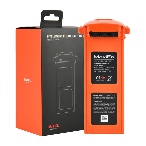
5.8G: ≤30dBm (FCC/ISED/SRRC); ≤14dBm (CE/UKCA)Bluetooth Bluetooth 5.0 Bluetooth Operating Frequency 2.400–2.4835 GHz Bluetooth EIRP ≤20dBm Type TFT LCD Dimensions 7.9 inches Maximum Brightness 2000 nits Resolution 2048×1536 Refresh Rate 60Hz Touch Control Supports 10-point touch Operating Temperature 0 ~ +45℃ Battery Type LiPo 3S Rated Capacity 7100 mAh Battery Energy 82 Wh Voltage 11.55 V Charging Voltage Limit 13.2 V Rated Charging Power 66 W Maximum Charging Power 93 W Weight 365 g Battery Charging Temperature +5 ~ +45℃
(Charging stops below 5℃ or above 45℃) -
Autel EVO II Pro RTK V3 Package List

Autel EVO II Pro RTK V3 Enterprise Bundle Package List

-
Name
Download EVO II RTK V3 Brochure - EN.pdf
Specs For EVO II RTK Series V3 - .pdf
Autel Smart Controller V3 Brochure
Specs For Autel Smart Controller V3
-
Autel Robotics EVO II RTK Series Quick Questions & Quick Answers
Q: What is the main difference between RTK series products and other EVO II series products?
Q: What is the effective image transmission range of the RTK Series?
Q: In real-time mapping, can the aircraft continue mapping while the image transmission signal is lost?
Q: What is the screen size and resolution of the remote controller?
Q: Which RTK base station modes are currently supported?
Q: What is the RTK positioning accuracy?
Q: What is the difference between PPK and RTK mode and how to choose?
Q: Does Autel EVO II RTK series provide measurements in relative coordinates or absolute coordinates?
Q: Does the aircraft support lossless zoom?


Deliver to
Deliver to
Free Fast Arrival by: -


