


Wildlife Management with Drone Thermal Imaging in the Field
As drone technology continues to advance, thermal imaging drones are becoming a transformative tool for wildlife monitoring, research, and management. From tracking wildlife at night to remotely patrolling pasture boundaries, these devices are reshaping the way we interact with nature.
Thermal imaging with drones is extremely beneficial in the wild, providing unparalleled visibility, precision, and non-invasive observation capabilities. The advent of thermal imaging drones has revolutionized the way researchers, conservationists, and land managers monitor and protect wildlife.
Why thermal imaging?
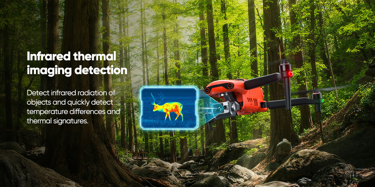
Traditional visible light photography is limited in darkness, fog, smoke, or dense vegetation. Thermal imaging, on the other hand, captures infrared radiation to show the distribution of heat sources, allowing us to "see" targets that are invisible to the naked eye. Especially at night, differences in heat distribution are more obvious.

All-weather, day and night visibility
Thermal imaging drones are usually equipped with dual camera lenses, such as the Autel EVO II 640T V3, 8K visible light camera and 640*512 thermal imager, which are not afraid of day and night, and perform better in low visibility conditions.
Thermal imaging cameras can detect heat, do not need lighting at night, and have zero disturbance to animal behavior.
Non-invasive observation
Wildlife research and protection often require minimizing disturbance to animals and their habitats. Thermal imaging drones enable researchers to observe wildlife from a safe distance (usually hundreds of feet in the air) without interfering with their natural behavior.
Thermal imaging drones with zoom can locate heat sources at a long distance. This non-invasive method is particularly important for studying timid or endangered species.
High-altitude high-quality imaging
Modern thermal imaging drones, such as the Autel 640T V3, can capture high-resolution images from 300-400 feet in the air. These images provide clear and detailed heat signatures that easily penetrate poor visibility environments, allowing accurate identification of animals even in dense foliage or complete darkness.
Accurate Temperature Measurement and GPS Positioning
Thermal imaging cameras can detect heat and provide geo-tags on photo information, which can fully enhance field response capabilities and accurately display data on animal location, health status and environmental conditions.
How do thermal imaging drones help wildlife management?
Thermal imaging drones are revolutionizing wildlife management through a wide range of applications. From wildlife monitoring and population surveys, migration tracking and habitat assessments, livestock and predator management to search and rescue and public safety, AI tracking provides continuous monitoring and remote management for large ranches or wildlife reserves.
Wildlife Detection and Habitat Assessment
Tracking wildlife and recording related living habits in the wild is not easy. Thermal imaging drones have brought a new turn, allowing researchers and rangers to operate in remote and rugged terrain with limited visibility.
- Thermal imaging drones track nocturnal species at night and monitor wildlife migration paths
- Collect terrain, vegetation and water source map data around habitats to assess threatened habitats
- Count species numbers (such as deer) non-invasively from a long distance without disturbing the living environment
- Record the activity patterns of nocturnal animals, such as owls, bats or large cats that are active at night
Farm and ranch patrols and livestock protection
For large ranchers, managing thousands of cattle and sheep is very time-consuming and labor-intensive. The emergence of drone thermal imaging has made many difficulties easier.
- Monitoring livestock location and health
- Identify injured or out-of-group individuals
- Patrol boundary fences to prevent escape or theft
- Detect the activities of nocturnal predators (such as coyotes, wild boars, etc.)
- During the hunting season, drones can help track escaped prey to improve safety and efficiency.
Fire warning and public safety
Wildfires are often unpredictable and extremely harmful, so it is also very necessary to use thermal imaging to observe wildfires. Thermal imaging drones can fully detect hot spots in forests or grasslands, and conduct early prevention and monitoring. They are the preferred tool for emergency response teams.
- Early detection of forest fires
- Search for missing persons or stranded animals
- Post-disaster heat source detection and analysis
- Suspicious activity monitoring and on-site command assistance
Excellence of Autel 640T V3 Thermal Imaging Drone in Wildlife Management

$1200 OFF 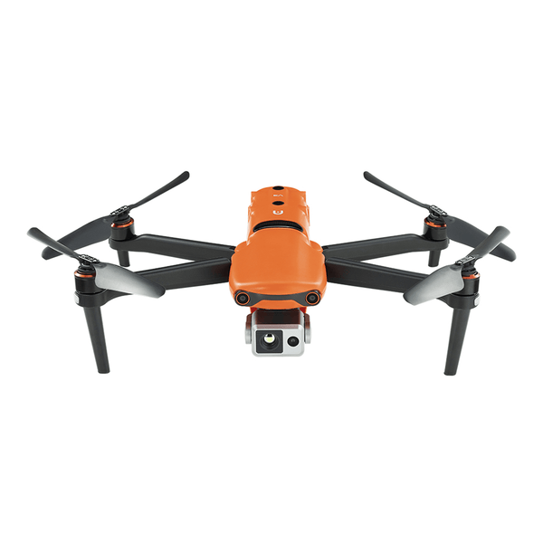
Autel Robotics EVO II Dual 640T V3 Thermal Drone Rugged Bundle
$4799.00 USD
The Autel 640T V3 Thermal Imaging Drone is a model of thermal imaging drones tailored for wildlife protection. Its main features include:
High-resolution thermal imaging: The 640x512 thermal sensor provides a clear heat signature, ideal for observing wildlife or livestock from high altitudes.
Geotagging: Each image includes GPS coordinates, and ground teams can use tools such as Google Maps to accurately locate the location of animals.
Automatic mapping: Create flight paths, route missions for large-scale monitoring, and synchronize data for detailed analysis.
AI tracking: Lock and autonomously track specific targets, simplifying the difficulty of tracking mobile animals.
Rugged design: Designed to work in harsh conditions, including smoke, fog or extreme temperatures.
Long flight time: Can fly for long periods of time to cover wide areas such as pastures or forests.
Read More: Autel EVO II 640T Thermal Drones For Wildlife Management
Remote wildlife management solutions in remote areas: EVO Nest + MAX 4T/4TXE/4N

For large pastures or uninhabited areas, traditional operation methods are often limited. The EVO Nest drone docking system launched by Autel enables remote deployment and control, allowing drones to operate autonomously in remote areas.
The EVO Nest docking station allows drones to take off, land and charge independently and be remotely controlled from a computer. For large pastures or wildlife reserves, this setup ensures continuous monitoring without constant human intervention.
The Autel EVO Nest, paired with the Autel EVO MAX 4T or MAX 4TXE or MAX 4N, can achieve all-weather intelligent monitoring, whether it is used for field animal behavior research or night patrols on farms, perfectly improving efficiency and maintaining sustainable development.
Summary
Drone field thermal imaging has changed the way and means of wildlife management and ecological monitoring, providing non-invasive high-tech solutions. For environmental organizations, ranchers, research institutions and even emergency departments, this is no longer a "cutting-edge technology" but a realistic and feasible solution.