


How Professional Drones Are Applied in Marathon Event Organizing: 1 Event Timeline, 3 Key Phases
Marathon has become a popular mass activity in countries and regions around the world. In recent years, the number of participants and the scale of marathon venue events have continued to increase dramatically, beloved by runners and enthusiasts alike. According to dimarket statistics, the 2025 market value is in the range of $500 million to $750 million. Considering a conservative CAGR of 8%, participation is exceeding 10 million participants annually by 2024. As a result, these races have become sporting events that achieve a win-win situation of tremendous commercial value and social value in promoting healthy lifestyles.
Critical Issues in Marathon Event Planning and Safety Supervision
However, serious problems with marathon running race organisation and process safety supervision have been repeatedly reported, raising alarming concerns about event regulations compliance. These issues are starkly reflected in data. According to a Global Runner Survey by Running USA, 5,500+ respondents’ evaluation of factors for choosing to register for events showed that preferred distance, preferred location, convenient location, and organizer reputation accounted for 66%, 53%, 31%, and 26% respectively. These statistics expose a critical truth: these factors rigorously test the working capabilities of organizers, and failure to meet expectations can devastate an event’s reputation.
The Alarming Reality of Poor Marathon Organization and Management
Poor marathon organization and management issues are disturbingly frequent in news reports. Consider these critical failures: errors(the news claims these errror) in marathon race runway data acquire during route distance surveying have invalidated entire events; Boston Marathon-style terrorist attacks have demonstrated catastrophic security vulnerabilities; participants experiencing sudden cardiac events have died when marathon day logistics and medical resources failed to respond quickly; and residents consistently complain about grossly insufficient traffic dispersal efficiency after marathons conclude.
The fundamental problem is clear: traditional marathon full-process management work relies primarily on manpower and ground mobile surveillance methods, creating dangerous three-dimensional blind spots and critical supervision dead zones that put lives at risk.
Revolutionary UAV Drone Applications Across the Marathon Timeline
Therefore, professional unmanned aerial vehicles can perform comprehensive work across the complete marathon event timeline from preparation to conclusion through advanced aerial oversight capabilities. Marathon inspection monitor aircraft provide the elevated perspective that ground-based systems simply cannot match.
First Time Point: Preparation Phase
The preparation work for marathons primarily involves assisting authorities in acceptance supervision after route planning and route marking engineering completion. These steps to organize a marathon must meet the stringent supervision requirements and event regulations of local sports institutions and national authoritative athletics organizations.
Geographic and Environmental Data Collection with Survey Mapping Drone Technology
Professional marathon runway aerial survey operations conduct geographic and environmental meteorological data measurement using advanced 3D mapping with drone technology to research and compare the most suitable racing routes with unprecedented precision.
The greatest marketing and safety imperative for marathons is showcasing local landmarks, beautiful scenery, and race routes that guarantee runner safety. Different perspectives from UAV aerial investigate in nature environment operations present dramatically different marathon scenery, giving running enthusiasts uniquely compelling experiences. Some marathons involve challenging terrain conditions requiring running race environment photo capture tool documentation for subsequent supply station setup and traffic guidance planning.
Elevated Bridges, Tunnels, and Cross-Sea Bridge Marathons: Critical attention must be paid to actual road and bridge height differences, spans, air humidity, and wind conditions. These factors determine whether marathon runners can focus optimally on energy allocation. Events like Hong Kong’s Central Kowloon Route Run demand precise drone aerial thermometer measurements for accurate environmental assessment.
Mountain Trail and Mountain City Marathons: Rigorous attention to ground slope differences, geological disaster-prone soil and water conditions, weather patterns, forest and slope visibility conditions, and logistics support workspace evaluation is non-negotiable. Marathon racing runway mapping capabilities must create comprehensive survey maps providing critical information support for emergency fire services.
Critical Limitations of Traditional Survey Methods
The harsh reality is undeniable: data obtained through traditional manual field research and AI model big data historical backtesting contains significant data distortion and noise factors. These methods consume excessive manpower costs and time while creating dangerous blind spots that compromise safety assessments.
Superior UAV Quadcopter Advantages in Geographic and Meteorological Measurement
The application of professional unmanned aerial vehicles in geographic and meteorological condition environmental measurement demonstrates overwhelming advantages in universal applicability and comprehensiveness.
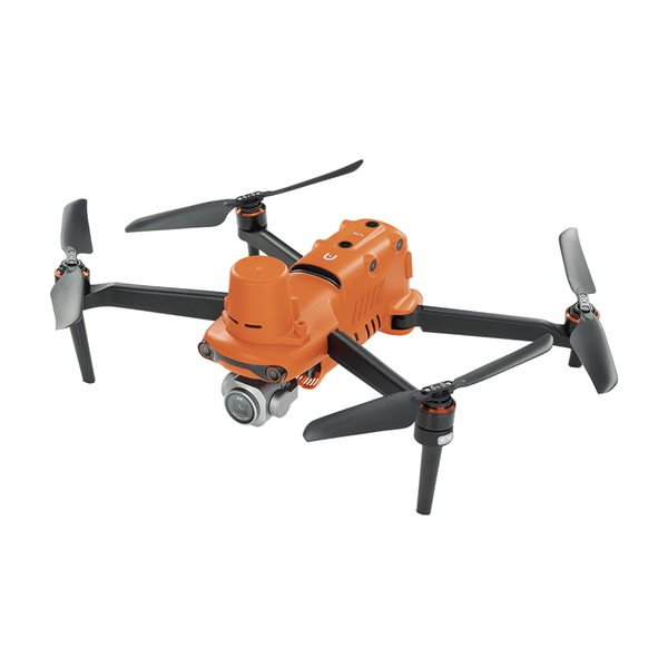
Autel company’s survey mapping drone capabilities including RTK positioning, RMG and NSL data monitoring prove this conclusively.
First, drone aerial thermometer instruments can be externally mounted for remote-controlled flight to collect precise track humidity, temperature, and atmospheric conditions with scientific accuracy.
Second, uav quadcopter systems can execute multiple low-altitude bridge passes, capturing altitude parameters through AGL and MSL sensors to analyze elevated highway height differentials with centimeter-level precision.
Third, RTK motion GPS modules combined with ground station data enable marathon race runway data acquire operations achieving distance positioning accuracy that eliminates certification-threatening measurement errors.
Fourth, advanced 3D mapping with drone technology performs comprehensive slope terrain information scanning to generate detailed surface terrain modeling data essential for safety planning.
Fifth, the drone with vision and loudspeaker capabilities combined with multi-directional automatic obstacle avoidance enable real-time obstacle monitoring and geological danger zone marking, providing essential track construction and hazard prevention data.
Pre-monitoring Survey of Surrounding Traffic Environment with Aerial Equipment
Marathon traffic investigation aerial equipment conducts comprehensive pre-monitoring surveys of surrounding traffic environments, analyzing daily passenger flow aggregation patterns, intersection pedestrian volumes, and public transportation utilization to support subsequent dispersal planning.
Traffic flow surveys represent a critical component of city and town-level marathon securing aerial inspection operations. These surveys directly impact passenger flow dispersal plans and significant public safety interests, including counter-terrorism measures and stampede prevention protocols. This data is essential for marathon submission to local government authorities and official approval processes.
Traditional traffic flow surveys commissioned to third-party companies using big data backtesting methods produce estimates with questionable reliability. Government traffic data requests involve lengthy approval processes creating unacceptable delays.
Fundamental Challenges with Conventional Traffic Data Collection
These conventional approaches suffer from identical data distortion and noise problems as meteorological surveying, critically limited by local camera resolution inadequacies and frequently lacking complete server technology infrastructure and intellectual resource investment necessary for accurate analysis.
However, uav swarm monitor and inspection capabilities transform this challenge into a straightforward operation. Within legal airspace free from no-fly zone restrictions and compliant with FAA regulations, marathon organizers can conduct comprehensive day and night passenger flow monitoring across race area roads through autonomous flight route execution, capturing authoritative first-hand data impossible to obtain through other means.
Systematic Patrol and Inspection for Hazards Using Marathon Multi-angle Inspection
Marathon multi-angle inspection operations conduct systematic patrol surveys identifying sensitive areas and obstacles that could cause athlete injuries.
Urban environments contain numerous hazards: vertical power line poles, deteriorating building wall debris and fragments, weathered architectural reliefs—any of which could become lethal projectiles endangering runners. Pre-event track surveying and hazard identification through UAV aerial investigate in nature environment operations enables early intervention and remediation, dramatically improving track safety ratings and insurance underwriting assessments. Drone with gimbal and loudspeaker systems execute target-locked multi-angle circumnavigation, capturing comprehensive obstacle documentation from multiple perspectives for rapid risk identification.
Systematic Verification Inspections
Professional marathon inspection monitor aircraft verify whether planned routes are properly equipped with barriers effectively blocking unauthorized people, vehicles, and objects.
Systematic inspection confirms whether logistics services are positioned at appropriate interval distances meeting support requirements.
Comprehensive verification ensures route markings comply with specified dimensions and provide sufficiently clear guidance for all participants.
Progress Supervision Through Running Race Environment Photo Capture Tool Documentation
Drone day and night monitoring using running race environment photo capture tool capabilities ensures track construction meets specified project milestones, creating comprehensive engineering documentation serving as authoritative information transparency evidence.
Current generation unmanned aerial vehicles achieve smooth flight characteristics, extended-duration hovering stability, drift-free positioning, and multi-angle photography capabilities. These systems support extended image transmission ranges with visual algorithm target locking of relevant markers, enabling remote control terminal operators to conduct real-time analysis. This dramatically reduces supervision personnel workload complexity while substantially improving inspection efficiency and accuracy.
Second Time Point: Competition Phase
Four Critical Monitoring Situations Requiring Marathon 911 Backup Inspection in the Air
The marathon competition phase demands monitoring four critical situations through marathon 911 backup inspection in the air capabilities: emergency ground safety conditions( the experienced organizers prove it), medical support coordination, aerial security enforcement, and competition result validity verification.
Emergency Ground Safety Conditions
Marathon securing aerial inspection primarily addresses counter-terrorism requirements. Through systematic drone patrols with target-locking capabilities, security teams identify suspicious explosives and persons of interest, exchanging real-time data with security authorities and commercial security teams to eliminate potential threats and accelerate response execution. Unmanned rescue drone capabilities scan nearby buildings for dangerous conditions including suspicious heat signatures and unstable non-permanent fixtures at risk of collapse.

Aerial Security Enforcement
Surveillance uav swarm monitor and inspection systems cooperate with ground-based drone countermeasure equipment to identify and intercept unauthorized drones penetrating marathon no-fly zones. Continuous monitoring detects and enables removal of airborne objects presenting safety hazards within the event airspace.
Medical Support Coordination
The professional drone with gimbal and loudspeaker maintains real-time connection with remote control backend operations, tracking athletes exhibiting signs of physical distress. Immediate communication with accompanying medical runner teams enables rapid medical intervention while backend systems simultaneously notify hospital facilities for seamless case management. This unmanned rescue drone coordination capability has proven essential for marathon 911 backup inspection in the air operations.
Competition Validity Verification(Many organizer approval)
Marathon regular event aerial photography using professional unmanned aerial vehicles captures comprehensive participant behavior documentation. Through wide-angle and telephoto lens switching capabilities, high-definition tracking monitors suspicious athlete behavior with immediate feedback to finish line officials ensuring competition fairness and athletic integrity.
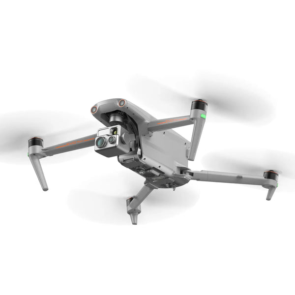
These sophisticated capabilities are fundamentally impossible for consumer-grade drones to achieve. Professional-grade unmanned aerial vehicles with specialized equipment are absolutely required. Autel drones deliver high-definition gimbal cameras enabling seamless wide-angle and telephoto switching, precision target locking, and autonomous flight planning that make these critical capabilities operationally achievable.
Third Time Point: Post-Competition Crowd Dispersal Phase
Professional uav swarm monitor and inspection operations deploy multi-area monitoring coverage using drone with vision and loudspeaker systems and drone aerial trumpet capabilities broadcasting departure instructions and safety reminders.
These operations coordinate closely with local public transportation operators and traffic police, providing real-time aerial guidance supporting ground personnel directing dispersing crowds through designated quick-passage routes and open assembly areas. This coordinated approach achieves efficient traffic transfer and passenger flow dispersal, promoting public transportation departure options while dramatically reducing ground traffic congestion risks and managing the intense guidance pressure of surging post-event traffic volumes.
Conclusion
Professional unmanned aerial vehicles deliver comprehensive marathon management capabilities spanning preparation, event operation, and conclusion supervision across one complete timeline and three critical time points. These advanced systems effectively reduce project development costs while eliminating the dangerous potential for human oversight inherent in traditional two-dimensional analysis approaches.
The evidence is conclusive: organizations serious about marathon running race organisation excellence and participant safety must integrate professional UAV aerial survey and inspection capabilities into their operational framework. The steps to organize a marathon successfully now definitively include comprehensive drone deployment strategy.


