


In real estate, construction, and property inspection, mapping homes with drones is becoming the new standard. Accurate, fast, and cost-effective—drones make it easier than ever to generate 2D orthomosaics , 3D models , and roof inspections with minimal human effort.
But here’s the big question:
What is the best drone that can map homes accurately and reliably?
If you're looking for a drone that can map homes professionally, Autel Robotics offers some of the most capable and user-friendly drones for the job. For high-precision mapping drones, the support of RTK drones is indispensable.

Why Use a Drone to Map Homes?
Before we dive into Autel models, here’s why drones are ideal for home mapping:
- High-resolution imagery for precise measurements
- GPS-enabled flight paths for automated data collection
- 3D modeling of rooftops, facades, and terrain
- Cost savings vs manual inspections or traditional surveying
- Time efficiency — map a full property in under 20 minutes
- Centimeter-level mapping accuracy — accurately create detailed maps and 3D models of real estate, including large estates and commercial properties
Best Autel Drones That Map Homes
Autel drones are known for combining professional-grade sensors with user-friendly interfaces, making them perfect for residential mapping—even if you're new to drone surveying.
Here are the top models:

Autel EVO II Pro RTK V3 - The flagship drone for high-resolution mapping
- 6K camera with 1" CMOS sensor
- Built-in RTK module, supports RTK, PPK, network RTK
- Supports photogrammetry with apps like DroneDeploy, Pix4D, or Autel Mapper
- 360° obstacle avoidance — ideal for flying close to structures
- 15 km transmission range
- Up to 40 min flight time
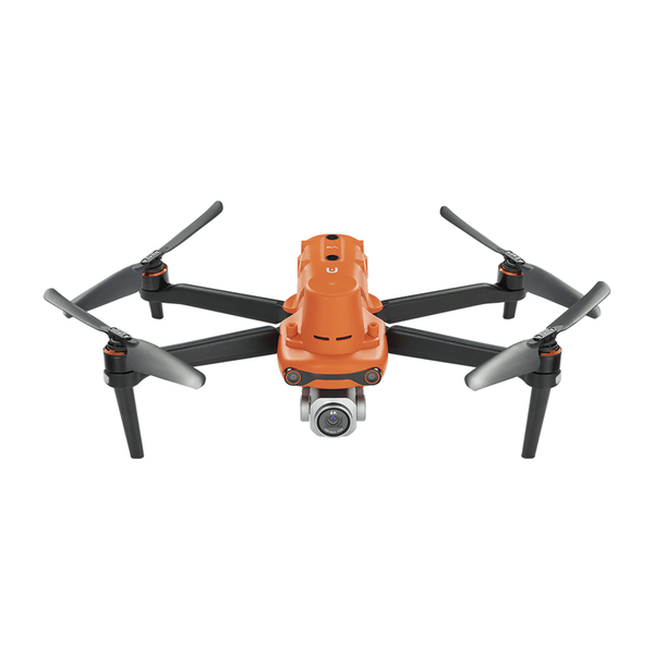
Autel Robotics EVO II Pro RTK V3 [Including RTK Module]
$2999.00 USD
The Autel RTK drone series includes the EVO II PRO RTK V3, EVO II 640T RTK V3, and MAX 4T/4N with RTK, for precision mapping and geotagging. Autel mapping drones are easy to learn and are great for real estate agents, small surveyors, licensed surveyors, insurance inspectors, and roofing contractors.

Real-World Application: How Autel Drones Map Homes
Here’s what you can do with Autel drones in home mapping:
| Application | Details |
|---|
| Roof Inspections | Identify cracks, soft spots, and hail damage from the air |
| 3D House Modeling | Generate textured 3D models using photogrammetry software |
| Plot Mapping | Outline property boundaries and vegetation for landscaping |
| Solar Planning | Assess roof angle and shading for solar panel installations |
Final Thoughts: The Best Drone That Maps Homes?
If you're in real estate, roofing, solar installation, or surveying, Autel drones offer:
- High-resolution imagery
- Long flight time
- Reliable autonomous flight
- Industry-standard data outputs
- No-fuss user experience
Our Top Pick: Autel EVO II Pro RTK V3[$2,999.00] — the perfect blend of image quality, intelligent flight, and affordability for serious home mapping.
Want to Start Mapping Homes With a Drone?
We help professionals and small teams choose the right Autel rtk drone for their mapping needs.
Shop Autel drones for mapping Now with fast shipping & support


