


Rabbit Colony Control: Thermal Drone Wildlife Surveys and Services
Across the United States, rabbits are an important part of ecosystems. However, in some environments—such as commercial farms, orchards, vineyards, golf courses, and habitat restoration projects—rapid rabbit population increases can damage crops, saplings, irrigation systems, and native vegetation.
Traditional wildlife surveys typically require significant manpower and often involve walking or driving. Finding rabbits can be difficult and time-consuming, as they are most active at dawn, dusk, and night.
Now, thermal imaging drones are transforming how wildlife experts, land managers, and agricultural operators monitor rabbit populations. They can quickly identify rabbit activity hotspots without blindly searching and make informed management decisions.

Why Use Thermal Imaging Drones to Monitor Rabbits?
Unlike standard RGB cameras, thermal imaging sensors detect heat signals rather than visible light. This allows operators to locate rabbits even if they are partially obscured by grass, bushes, or rugged terrain.
Wild rabbits are nocturnal, and their fur blends seamlessly with dry grass and mud, making them extremely difficult to spot with the naked eye. Manual searches are dangerous and inefficient at this time. Thermal imaging drones, using a thermal color palette, clearly reveal rabbit activity, enabling faster, safer, and more stable wildlife monitoring.

Furthermore, high-end thermal drones are highly maneuverable, capable of accurately surveying hundreds of acres in just one hour. Drones equipped with thermal cameras can also plan repeatable flight paths, combining thermal imaging with RGB photography for long-term data comparison.
In thermal rabbit surveys, drone pilots must comply with all applicable Federal Aviation Administration (FAA) regulations, including applicable remote identification requirements, and obtain any necessary permits before flying over private or restricted property.
To learn more about the application of agricultural drones in biological control, click to read more articles we've compiled for you.
Read MoreCan thermal imaging drones detect rabbit populations?
While rabbits are fast runners and small, making them difficult to spot from high altitudes, the core reason thermal imaging drones are a powerful tool for pest control is their ability to utilize differences in the thermal radiation of objects.
Any object with a temperature above absolute zero will radiate infrared radiation. Live wild rabbits typically have a body temperature of around 38℃~40℃, while the ground temperature of grasslands at night or early morning is often significantly lower than this.
When using thermal imaging drones to track wild rabbits, we recommend conducting surveys at dawn, dusk, night, and in winter. Using a white-light palette and flying at an altitude of 50~100 meters allows you to clearly see the rabbits' movement patterns without disturbing them.
How to survey rabbit populations with thermal imaging drones?
Large-scale rabbit populations can cause significant damage to vegetable farms, vineyards, nurseries, orchards, farmland, grasslands, and forests. Therefore, using thermal drones for tracking surveys allows landowners to quickly prepare protective measures and reduce the rabbits' activity range.
Precise Palette Display
When surveying wild rabbits at night, a white-light palette is often used. In the infrared field of view of the drone's thermal camera, the background is a cool, dark gray, while the high-temperature wild rabbits appear as bright, pure white "heat sources." This makes rabbit tracking very clear and easy.
Counting and Tracking
The thermal imaging video streams collected by the drone can be transmitted back to the ground station in real time, accurately identifying the number, density, and movement trajectories of wild rabbits within the thermal imaging footage.
Locating Rabbit Burrows
Wild rabbits' damage to grasslands largely stems from burrowing. Thermal imaging drones can identify burrow entrances with temperatures different from the surrounding ground surface by detecting temperature variations. Locating rabbit burrows allows for better preparation for subsequent biological control or chemical control.
Thermal imaging drone surveys of rabbit populations can be used for agricultural damage assessment, habitat restoration projects, wildlife rabbit population surveys, and property and ranch management.
Recommended Thermal Imaging Drone Solution
1. Autel EVO II Dual 640T V3
The Autel EVO II Dual 640T V3 is ideal for routine wildlife monitoring and agricultural patrols.

Its advantages include:
- 640 × 512 thermal imaging resolution, capable of detecting small mammals
- High-resolution visible light camera for detailed recording
- Compact and foldable design for rapid deployment
- Reliable performance during dawn and dusk operations
$1200 OFF 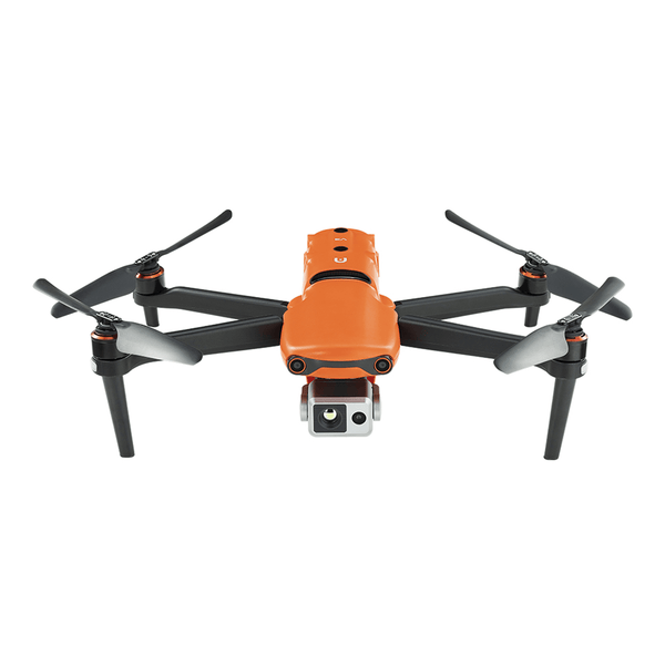
Autel Robotics EVO II Dual 640T V3 Thermal Drone Rugged Bundle
$3,899.00 USD
For land managers requiring a portable thermal imaging drone that can be deployed quickly, the EVO II Dual 640T V3 achieves an excellent balance between performance and portability.
2. Autel EVO Max 4T V2

For larger plots and more demanding environmental conditions, the Autel EVO Max 4T V2 offers additional features designed for professional operations.
Key advantages include:
- Advanced thermal imaging technology for enhanced target detection capabilities
- Enhanced obstacle avoidance capabilities, suitable for low-altitude flight near trees and rugged terrain
- Longer operating range for surveying large areas
- AI-assisted object recognition and tracking capabilities
- Rugged and durable design suitable for various harsh field environments
$1000 OFF 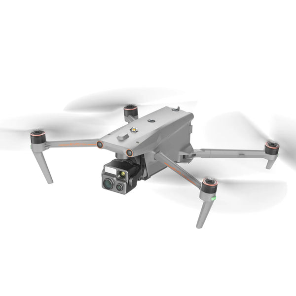
Autel Robotics EVO MAX 4T V2 Rugged Bundle
$5,699.00 USD
Large ranches, state wildlife management agencies, ecological restoration projects, and nighttime wildlife assessments can leverage the Autel EVO Max 4T V2 semi-autonomous drone to accelerate project operations and reduce the difficulty of surveying complex terrain.
Thermal drones support more efficient wildlife management
Thermal imaging drones are invaluable tools for observation, monitoring, and data collection. With the widespread adoption of thermal imaging technology, drones are becoming an essential component of modern wildlife management. Whether you're controlling rabbits in farmland, hunting wild boar in dense bush, or recovering deer with a thermal drone after dark.
In areas infested with rabbits, thermal drones can provide accurate information on rabbit distribution and activity, reducing unnecessary fieldwork and supporting more targeted and environmentally friendly management strategies.
Conclusion
In wildlife surveys and services, landowners can leverage the latest drone and thermal imaging technologies to monitor crop damage, support habitat restoration, conduct ecological surveys, and manage wildlife.
For organizations seeking a compact and versatile solution, the Autel EVO II Dual 640T V3 is ideal for routine monitoring. For large-scale operations requiring enhanced sensing, navigation, and endurance, the Autel EVO Max 4T V2 offers the advanced capabilities needed to handle harsh field conditions.
By combining thermal imaging with responsible flight operations, land managers can make more informed decisions that support agricultural productivity and healthy ecosystems.