


Drone for Aggregates: A Revolution in Aggregate Mining & Stockpile Measurement
The aggregate industry is undergoing a rapid digital transformation. From quarry operations and stockpile surveying to mine planning and environmental monitoring, drone technology has become one of the most valuable tools for improving efficiency, safety, and data accuracy.
In the rapidly evolving fields of mining, quarrying, and aggregate management, commercial drones equipped with high-resolution imaging systems, RTK positioning, LiDAR sensors, and AI analytics are transforming inventory accuracy and stockpile volume measurement into precise, automated tasks that take only minutes.
In this guide, we'll delve into how multi-sensor commercial drones are revolutionizing aggregate inventory management, why more and more quarry operators are adopting drone solutions, and how businesses can maximize their return on investment.
What are Aggregate Drones?
Aggregate drones are unmanned aerial vehicles specifically designed for the aggregate and quarry industries.
In Drone Stockpile Measurement and Quarry Surveying, professional commercial drones are used for tasks such as stockpile volume measurement, quarry mapping, mine surveying, topographic surveying, site inspection, environmental monitoring, and construction progress tracking.
Operators can collect high-precision aerial data in a very short time without relying on manual on-site measurements.

Why is the Aggregate Industry Adopting Drone Technology?
Before introducing drone technology to the aggregate industry, let's understand the fatal flaws and operational challenges of traditional stockpile surveying, and see how drone surveying can improve accuracy and simplify workflows.
Safety Hazards: Sending surveyors equipped with GPS rover stations or total stations to climb unstable, easily movable gravel or sand piles inherently poses safety hazards. Slipping, tripping, and falling are among the leading causes of workplace injuries in aggregate stockpiles.
Guessing Errors: Traditional methods use discrete point measurements. In large mines and complex environments, surveyors often overlook irregular contours, depressions, and uneven back surfaces when measuring stockpiles. This interpolation method can lead to inventory quantity errors of up to 10% to 15%.
Production Interruptions: Manual measurements can take several days. During this time, with tight production schedules and frequent inventory updates, heavy machinery often needs to be paused or bypassed, causing actual production to stall or slow down.
High Costs: Traditional measurement methods typically require surveyors, GPS equipment, and take hours or even days to complete. Furthermore, rising labor costs place a significant burden on operators.
UAV mapping offers a significant alternative for aggregate mining and stockpile surveying. UAV surveying can drastically reduce measurement time costs. RTK-equipped UAVs can directly perform automated flight missions and capture hundreds of overlapping images for photogrammetry software to generate 3D models, greatly improving overall measurement consistency.

UAV Solutions for the Aggregate Industry
Deploying enterprise-grade RTK UAVs equipped with high-resolution vision and thermal imaging payloads can completely solve these challenges. Drones don't need to measure dozens of points on a stockpile; a single 20-minute flight can collect millions of data points from aerial images.
1. RTK Accuracy
Modern enterprise-grade mapping drones have built-in RTK modules. RTK drones support RTK/PPK/network RTK. By receiving real-time correction data, the drone can geotag each aerial photograph, achieving centimeter-level horizontal and vertical accuracy. You can take off, map, and land without approaching hazardous stockpiles.
2. Multi-Sensor Fusion
Aggregate yards have harsh environments, often affected by dust, glare, and changing light conditions. Therefore, multi-sensor payloads (such as the Autel EVO II Dual 640t V3 or EVO Max series) are indispensable:
High-resolution visible light sensor: Captures clear 4K orthophotos (orthomograms) to build a 3D mesh model of the terrain.
Thermal infrared sensors: Help differentiate the moisture content or heat absorption rate of different materials, ensuring that vegetation or water accumulation at the bottom of the aggregate pile does not affect volume calculations.
3. Data Processing
After the drone completes its autonomous flight, the captured images are processed using photogrammetry software (such as Pix4D, Autel Mapper, or specialized mining platforms).
This software stitches the images into a dense point cloud and creates a digital surface model (DSM). Because the drone can capture every contour, depression, and peak of the aggregate pile, volume calculation errors can be reduced to less than 1% to 3%.

How to Choose the Right Aggregate Mapping Drone?
A quarry mapping drone is versatile, reliable, and safe, significantly improving work efficiency and generating high-precision measurement data. This allows managers to access the latest aerial data, enabling faster decisions regarding engineering and operational planning, production, inventory, and site development.
Therefore, when selecting aggregate management drones, prioritize the following factors:
- RTK positioning
- Flight time
- Camera resolution
- LiDAR functionality
- Software compatibility
For small to medium-sized mines, high-resolution RTK drones are sufficient. For large-scale mining projects, autonomous drones like the EVO Max series, which support collaborative operations, can be used. Drone swarm collaboration can significantly improve operational efficiency, even generating updated maps daily.
Rugged and reliable enterprise-grade drone platforms for aggregate management
Product Recommendation 1: Autel EVO II Pro RTK V3 / Dual 640t RTK V3
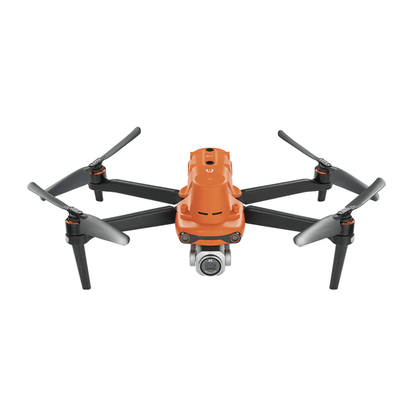
Autel Robotics EVO Pro RTK V3
$2,995.00 USD
6K Camera | 1-inch Sensor | 20MP Photo | 40mins flight time Buy Now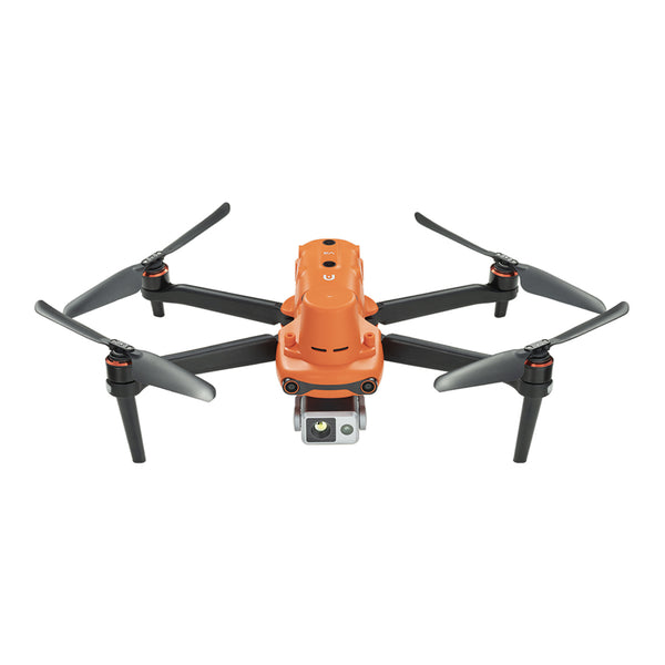
Autel Robotics EVO II Dual 640T RTK V3
$5,799.00 USD
640*512 Thermal Camera | 8K RGB Camera | 50MP Photo | 38mins flight time Buy NowReasons for suitability: The EVO II RTK series drones are lightweight and portable, with interchangeable high-resolution and thermal imaging camera payloads. The high-precision RTK module supports GCP-free mapping. Ideal for daily or weekly inventory checks.
Product Recommendation 2: Autel EVO Max 4T / 4N
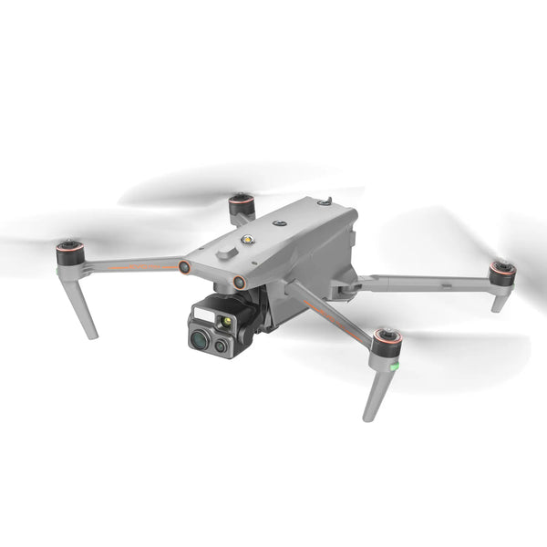
Autel Robotics EVO Max 4T
$5,699.00 USD
640*512 Thermal Camera | 1.2km Laser Rangefinder | 50MP Wide Camera | 160x Zoom Camera Buy Now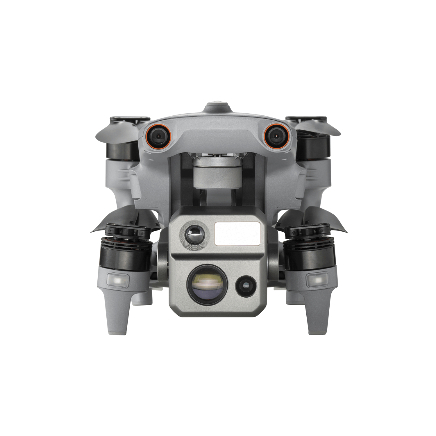
Autel Robotics EVO Max 4N
$8,999.00 USD
640*512 Thermal Camera | 1.2km Laser Rangefinder | 50MP Wide Camera | 0.0001 LUX Starlight Night-Vision Camera Buy NowReasons for Use: Designed for extreme industrial-grade durability, featuring IP43 protection, hot-swappable batteries, and an advanced A-Mesh network, suitable for large quarries with severe signal interference.
Conclusion
Drone technology has fundamentally changed how aggregate producers collect, analyze, and manage field data. Whether for inventory measurement, quarry mapping, mine surveying, safety inspections, or environmental monitoring, aggregate drones offer faster workflows, higher accuracy, and safer operation.
Ready to digitize stockpile management? Start by purchasing a high-tech RTK drone from the Autelpilot store.
Frequently Asked Questions
Is the accuracy of drone stockpile measurements sufficient?
Yes, RTK drones can achieve centimeter-level accuracy. RTK-enabled drones, combined with specialized processing software, can provide high-precision volumetric calculations suitable for many operational and engineering applications.
How often should aggregate companies conduct drone measurements?
Many businesses conduct measurements weekly or monthly, while high-volume quarries may require daily flights.
Can drones replace traditional surveying?
Drones complement traditional surveying by significantly increasing speed and efficiency. While driving digital transformation, ground surveying may still be necessary for certain legal, engineering, or border-related applications.
Is drone surveying cost-effective?
For most medium and large aggregate operations, drone surveying can reduce labor costs, shorten project timelines, and improve inventory accuracy, making it a cost-effective investment.