


Case Study: 3D Construction Surveying with EVO II 640T RTK Enterprise V3
Drone-based 3D surveying is changing how professionals collect and analyze spatial data, making workflows faster, safer, and more efficient. The Autel 640T RTK Enterprise V3, a professional drone platform, provides project teams with accurate measurement data, as-built records, and powerful visualizations. Let's delve into the secrets of drone-based 3D building surveying.
What is Drone-Based 3D Building Surveying?
The photogrammetric technology carried by surveying drones, combined with LiDAR technology, ultimately acquires highly overlapping images or laser echoes, which are then processed into dense point clouds, digital surface models, and textured 3D meshes.
Using drones for 3D building surveying can be applied to all stages of modern building projects, from pre-construction planning to structural monitoring and project documentation. The building and terrain visualization models generated by 3D drone surveying are highly detailed, flexible, and accurate.
Why Use 3D Drone Surveying in Building Projects?
To achieve accurate 3D drone-based architectural surveying, engineers need not only a solid grasp of surveying knowledge but also a thorough understanding of drone flight and the importance of RTK (Real-Time Kinematics) technology in drone surveying.
The core advantages of surveying drones lie in RTK technology and LiDAR. RTK utilizes calibration data to achieve centimeter-level positioning accuracy in real time. The Autel EVO II Dual 640T RTK Enterprise V3, equipped with this key technology, has become a favored product among surveyors.
The Autel 640T RTK Enterprise V3 industrial drone possesses high-precision surveying, inspection, and enterprise-level aerial photography capabilities. In construction projects, it enables large-scale, high-precision measurements, improving safety and efficiency, and enhancing team coordination and communication.
Advantages of the Autel 640T RTK Enterprise V3 in Drone Mapping
The Autel 640T RTK Enterprise V3 commercial drone is designed for enterprise professionals who require reliable aerial data acquisition under demanding operating conditions.
$900 OFF 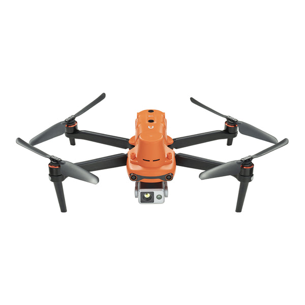
Autel Robotics EVO II Dual 640T RTK Enterprise V3 Thermal Drone
$4,999.00 USD
Key features include:
1. Centimeter-level RTK Positioning
The integrated RTK module provides high-precision positioning data, accurate to the centimeter level, crucial for accurate mapping tasks. This allows operators to generate highly reliable 3D models while reducing manual correction work in post-processing.
2. High-Resolution Imaging
Accurate 3D modeling begins with image quality. The advanced dual-camera system captures highly detailed images, enhancing the performance of photogrammetry software during model reconstruction.
The visible light camera features a 0.8-inch CMOS and 50MP 8K RYYB sensor, while the thermal imager is equipped with a 13mm focal length lens, capable of recording at 640 x 512 resolution and a 30Hz sampling rate.

In construction mapping projects, this helps engineers create digital surface models (DSMs), orthophotos, detailed building elevations, high-density point cloud models, and visualize construction progress.
3. Faster Measurement Coverage
Traditional ground surveying can take hours or even days to complete large-scale survey projects. The Autel 640T RTK Enterprise V3 enables operators to complete measurements of the entire construction area in a single flight, significantly improving project efficiency.
4. Safe Structural Inspection
Many construction and industrial inspection projects involve hard-to-reach areas.
Using drones for inspections eliminates the need for personnel to travel to hazardous high-altitude areas. The 640T RTK Enterprise V3 industrial drone's 16x zoom capability and thermal imaging clearly reveal potential risks to critical structural components.
Practical Applications of 3D Drone Construction Surveying
The application of professional RTK drones continues to expand across multiple industries, generating accurate 3D progress reports for project managers and stakeholders.

Topographic and Pre-Construction Survey:
A detailed topographic model and existing condition dataset are established before the commencement of major works to support site grading design, drainage planning, and on-site logistics.
Excavation, Fill, and Volume Analysis:
The volume of stockpiles, borrow areas, and excavations is calculated using 3D surfaces and point data to reliably support payment requests and cost control.
Structural and Civil Engineering As-Built Drawings:
Capture steel, concrete, utilities, and site features in 3D so engineers and the BIM team can verify that completed work conforms to the design model and tolerances.
Schedule, Quality Assurance/Quality Control, and Clash Detection:
Compare 3D measurement data with planned surfaces and models to identify clashes, over-construction, beveling, and other issues to prevent rework.
Conclusion
It's time to upgrade your traditional surveying projects, and precision determines project success.
The Autel 640T RTK Enterprise V3 provides professionals with the performance they need to capture smarter data, complete projects faster, and operate with greater confidence. Choose the right drone technology to optimize your workflow efficiency.